Holzkirchen, Upper Bavaria
Holzkirchen | |
|---|---|
 The old and new town halls in Holzkirchen | |
| Coordinates: 47°53′N 11°42′E / 47.883°N 11.700°E | |
| Country | Germany |
| State | Bavaria |
| Admin. region | Upper Bavaria |
| District | Miesbach |
| Subdivisions | 35 districts |
| Government | |
| • Mayor | Christoph Schmid (CSU) |
| Area | |
| • Total | 48.33 km2 (18.66 sq mi) |
| Elevation | 691 m (2,267 ft) |
| Population (2022-12-31)[1] | |
| • Total | 16,722 |
| • Density | 350/km2 (900/sq mi) |
| Time zone | UTC+01:00 (CET) |
| • Summer (DST) | UTC+02:00 (CEST) |
| Postal codes | 83607 |
| Dialling codes | 08024 |
| Vehicle registration | MB |
| Website | www.holzkirchen.de |
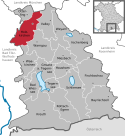
Holzkirchen is a market town in the district of Miesbach in Upper Bavaria in Germany. It has over 16.000 inhabitants. It has a lot of industry. Holzkirchen is the largest town in their district.
Climate[change | change source]
Holzkirchen has a normal European climate. It has winters with temperatures from 5 to -5 degrees Celcius and summers with temperatures from 12 to 26 degrees Celcius.
Smaller parts[change | change source]
Holzkirchen has many surrounding parts that belong to the city.
The biggest ones are Erlkam, Föching, Großhartpennung, Kleinhartpenning and Roggersdorf.
History[change | change source]
The area was already settled since the Bronze Age. During the Roman Ages, two streets crossed in Holzkirchen. During World War 2, Holzkirchen was not damaged badly.
References[change | change source]
- ↑ Genesis Online-Datenbank des Bayerischen Landesamtes für Statistik Tabelle 12411-003r Fortschreibung des Bevölkerungsstandes: Gemeinden, Stichtag (Einwohnerzahlen auf Grundlage des Zensus 2011)
Other websites[change | change source]
Wikimedia Commons has media related to Holzkirchen, Upper Bavaria.
- Official website (in German)


