Ituri Province
Appearance
Ituri Province | |
|---|---|
 | |
| Coordinates: 1°50′N 29°30′E / 1.833°N 29.500°E | |
| Country | |
| Capital | Bunia |
| Largest city | Bunia |
| Area | |
| • Total | 65,658 km2 (25,351 sq mi) |
| Population (2005 est.) | |
| • Total | 4,241,236 |
| • Density | 65/km2 (170/sq mi) |
| Official language | French |
| National language | Swahili |
| Website | http://provinceituri.co/ |
Ituri is one of the 26 provinces of the Democratic Republic of the Congo.[1] Its capital is Bunia.[2]
Geography
[change | change source]
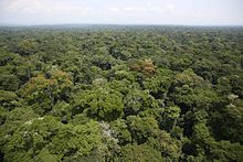
The Ituri Rainforest is in this area. It is located northeast of the Ituri River and on the western side of Lake Albert. It has borders with Uganda and South Sudan. The five administrative territories of Ituri are:
References
[change | change source]- ↑ Central Intelligence Agency (2016). "Democratic Republic of the Congo". The World Factbook. Langley, Virginia: Central Intelligence Agency. Archived from the original on 31 August 2020. Retrieved 10 May 2016.
- ↑ "Provinces of the Democratic Republic of Congo". Statiods.com.
