
Jefferson County, Mississippi
Jefferson County | |
|---|---|
 | |
 Location within the U.S. state of Mississippi | |
 Mississippi's location within the U.S. | |
| Coordinates: 31°44′N 91°02′W / 31.73°N 91.03°W | |
| Country | |
| State | |
| Founded | 1799 |
| Named for | Thomas Jefferson |
| Seat | Fayette |
| Largest city | Fayette |
| Area | |
| • Total | 527 sq mi (1,360 km2) |
| • Land | 520 sq mi (1,300 km2) |
| • Water | 7.3 sq mi (19 km2) 1.4% |
| Population (2020) | |
| • Total | 7,260 |
| • Density | 14/sq mi (5.3/km2) |
| Time zone | UTC−6 (Central) |
| • Summer (DST) | UTC−5 (CDT) |
| Congressional district | 2nd |
| Website | www |
Jefferson County is a county in the U.S. state of Mississippi; its western border is formed by the Mississippi River. As of the 2020 census, 7,260 people lived there.[1] Its county seat is Fayette.[2] The county was founded in 1799. It is named for U.S. President Thomas Jefferson.[3]
References[change | change source]
- ↑ "QuickFacts: Jefferson County, Mississippi". United States Census Bureau. Retrieved January 4, 2024.
- ↑ "Find a County". National Association of Counties. Archived from the original on 2011-05-31. Retrieved 2011-06-07.
- ↑ Gannett, Henry (1905). The Origin of Certain Place Names in the United States. Govt. Print. Off. p. 168.
Municipalities and communities of Jefferson County, Mississippi, United States | ||
|---|---|---|
| City | 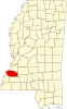 | |
| Unincorporated communities | ||
| Ghost towns | ||
| International | |
|---|---|
| National | |
| Other | |