Kanasín
Kanasín | |
|---|---|
City | |
 Main park of Kanasín. | |
| Coordinates: 20°56′04″N 89°33′28″W / 20.93444°N 89.55778°W | |
| Country | Mexico |
| State | Yucatán |
| Municipality | Kanasín |
| Government | |
| • Mayor | |
| Elevation | 9 m (30 ft) |
| Population (2020) | |
| • Total | 139,753 |
| • Demonym | Kanasinense |
| Time zone | UTC−6 (CST) |
| • Summer (DST) | CDT |
| Postal code | 97370 |
| Area code | 999 |
| Code | 310410001 |
| Climate | Aw |
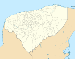
Kanasín is a city in the Mexican state of Yucatán. In 2020 it had a population of almost 140,000 inhabitants. It is part of the metropolitan area of Mérida, Yucatán.[1] Near the city is a Mayan archaeological site discovered in 2018 and named Xiol by archaeologists.
References[change | change source]
- ↑ "Municipios de Yucatán: Kanasín" (in Spanish). Retrieved 26 November 2022.
Wikimedia Commons has media related to Kanasín, Yucatán.


