Leo-Cedarville, Indiana
Appearance
Leo-Cedarville, Indiana | |
|---|---|
 | |
| Motto: "A Sense Of Community" | |
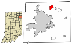
 Location of Leo-Cedarville in Allen County, Indiana. | |
| Coordinates: 41°12′54″N 85°0′56″W / 41.21500°N 85.01556°W | |
| Country | United States |
| State | Indiana |
| County | Allen |
| Township | Cedar Creek |
| Area | |
| • Total | 3.86 sq mi (9.99 km2) |
| • Land | 3.72 sq mi (9.65 km2) |
| • Water | 0.13 sq mi (0.34 km2) |
| Elevation | 797 ft (243 m) |
| Population (2020) | |
| • Total | 3,624 |
| • Density | 973.15/sq mi (375.70/km2) |
| Time zone | UTC-5 (Eastern (EST)) |
| • Summer (DST) | UTC-4 (EDT) |
| ZIP code | 46765[2] |
| Area code | 260 |
| FIPS code | 18-42861[3] |
| GNIS feature ID | 1681810[4] |
| Website | http://www.leocedarville.com/ |
Leo-Cedarville is a town in Cedar Creek Township, Allen County, Indiana, United States. The population was 3,624 at the 2020 census.
History
[change | change source]Before, Cedarville and Leo were different villages. Cedarville was planned out in 1838, and Leo was started in 1849, first called the Town of Hamilton.[5]
In 1996, Leo and Cedarville became one town called Leo-Cedarville. They did this to stop the nearby city of Fort Wayne from taking them over.
The Hursh Road Bridge was added to the National Register of Historic Places in 1981. But then, it was taken off the list in 1993.[6]
References
[change | change source]- ↑ "2020 U.S. Gazetteer Files". United States Census Bureau. Retrieved March 16, 2022.
- ↑ "Leo-Cedarville ZIP Code". zipdatamaps.com. 2022. Retrieved November 30, 2022.
- ↑ "U.S. Census website". United States Census Bureau. Retrieved January 31, 2008.
- ↑ "US Board on Geographic Names". United States Geological Survey. October 25, 2007. Retrieved January 31, 2008.
- ↑ Griswold, Bert Joseph; Taylor, Mrs. Samuel R. (1917). The Pictorial History of Fort Wayne, Indiana: A Review of Two Centuries of Occupation of the Region about the Head of the Maumee River. Robert O. Law Company. pp. 662–663.
- ↑ "National Register Information System". National Register of Historic Places. National Park Service. July 9, 2010.
