
List of districts of Sikkim
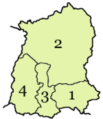
There are 4 districts in Sikkim, an Indian state, each overseen by a Central Government appointee, the district collector, who is in charge of the administration of the civilian areas of the districts. The Indian army has control of a large territory, as the state is a sensitive border area. Many areas are restricted and permits are needed to visit them. There are a total of eight towns and nine subdivisions in Sikkim. The four districts are:
| Code | District | Headquarters | Population (2011)[1] | Area (km²) | Density (/km²) | Map |
| ES | Gangtok district | Gangtok | 281,293 | 954 | 257 |  |
| NS | Mangan district | Mangan, India | 43,354 | 4,226 | 10 |  |
| SS | Namchi district | Namchi | 146,742 | 750 | 175 |  |
| WS | Gyalsing district | Gyalshing | 136,299 | 1,166 | 106 |  |
References
[change | change source]- ↑ "Ranking od (sic) Districts by Population Size" (XLS). The Registrar General & Census Commissioner, India, New Delhi-110011. 2010–2011. Retrieved 19 September 2011.