Maple Ridge, British Columbia
|
Photograph of Maple Ridge | |

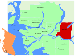
the location of Maple Ridge | |
| Area | 265.79 km²
68,949 (2006 census) |
| Location | 49°13'12" N 122°35'56" W |
| Created | 1874 |
| Province | British Columbia |
| Mayor | Ernie Daykin |
| Time Zone | Pacific (UTC-8)
V2X, V2W, V3Z, V4R 604, 778 |
Maple Ridge is a District Municipality (area with several settlements). It is in British Columbia, Canada.
History[change | change source]
Maple Ridge was created on September 12, 1874. It is the sixth oldest community in British Columbia.[1]
Location[change | change source]
Maple Ridge is located in southern British Columbia. It is to the east of Vancouver.
Maple Ridge is on the north shore of the Fraser River.[2]
Communities[change | change source]
Maple Ridge is a District Municipality. This means that there are several communities within the official borders of Maple Ridge. These communities are: Albion, East Haney, Hammond, Haney, Port Haney, Ruskin, Silver Valley, The Ridge, Thornhill, Webster's Corners, Whonnock, and Yennadon.[3]
Notable People[change | change source]
- Andrew Ladd - 2-time Stanley Cup winning ice hockey player
References[change | change source]
- ↑ "Maple Ridge - History and Heritage - About Maple Ridge". Archived from the original on 2010-04-11. Retrieved 2009-12-12.
- ↑ "Maple Ridge -About Maple Ridge". Archived from the original on 2009-10-17. Retrieved 2009-12-12.
- ↑ "Archived copy" (PDF). Archived from the original (PDF) on 2010-12-18. Retrieved 2009-12-12.
{{cite web}}: CS1 maint: archived copy as title (link)
