Maputo Province
This article may have too many red links. (April 2020) |
Maputo | |
|---|---|
 | |
 Maputo, Province of Mozambique | |
| Country | Mozambique |
| Capital | Matola |
| Area | |
| • Total | 22,693 km2 (8,762 sq mi) |
| Population (2017 census) | |
| • Total | 1,968,906 |
| • Density | 87/km2 (220/sq mi) |
| Postal code | 11xx |
| Area code | (+258) 21 |
| Website | www |
Maputo is a province of Mozambique. Its capital is the city of Matola. The province does not include the national capital of Maputo.
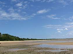
The Maputo Bay area to the southeast of Maputo is an important conservation area with many reefs and lakes. Of particular note is the Maputo Elephant Game Reserve, which has lakes such as Lagoa Chingute and Lagoa Piti. There is also the Machangulo Private Nature Reserve in the Machangulo Peninsula.[1] The largest river of the province is the Maputo River. Inhaca Island is part of the province.
Districts[change | change source]
Maputo Province is divided into the 7 districts of:
- Boane District
- Magude District
- Manhiça District
- Marracuene District
- Moamba District
- Namaacha District
- Matutuíne District
and the municipalities of:
References[change | change source]
- ↑ Google (22 September 2014). "Maputo Province" (Map). Google Maps. Google. Retrieved 22 September 2014.
Wikimedia Commons has media related to Maputo Province.
