Mymensingh
Mymensingh
ময়মনসিংহ | |
|---|---|
|
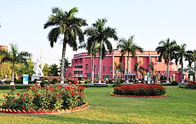
From top: Mymensingh Town, Shoshi Lodge, Mymensingh zero point, Zainul Abedin Museum, Bangladesh Agricultural University | |
Location of Mymensingh in Bangladesh | |
| Coordinates: 24.6343°0′0″N 90.2677°0′0″E / 24.63430°N 90.26770°E | |
| Country | Bangladesh |
| Division | Mymensingh Division |
| District | Mymensingh District |
| Establishment | 1787 |
| Granted city status | 1787[1] |
| Government | |
| • Type | City Corporation |
| • City Mayor | Ekramul Haque Titu [2] |
| Population | |
| • Total | 330,126 |
| Time zone | UTC+6 (BST) |
| Postal code | 2200, 2201, 2202, 2203, 2204, 2205, 2206 |
| Calling code | 91 |
| Website | mcc |
Mymensingh is a city of Bangladesh on the river Brahmaputra. It is the capital of Mymensingh Division. The city is known for institute like Bangladesh Agricultural University, Mymensingh Medical College, Mymensingh Engineering College, Ananda Mohan College, Mymensingh Muminunnesa Women College, Mymensingh Polytechnique Institute and Mymensingh Girls' Cadet College. Other landmark institutions include Mymensingh Army Cantonment. Mymensingh city is about 120 kilometres (75 miles) north of Dhaka which is the capital of the country.
References[change | change source]
- ↑ "Speech of Mayor on Spacial International Working Conference". Chittagong City Corporation. Archived from the original on 2007-11-25. Retrieved 2009-12-21.
- ↑ "AL retains majority, BNP fights back". Archived from the original on 2011-07-08. Retrieved 2011-01-18.


