Púchov
Púchov | |
|---|---|
Town | |
 The museum in Púchov | |
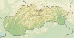
Location of Púchov in the Trenčín Region | |
| Coordinates: 49°07′12″N 18°19′50″E / 49.12000°N 18.33056°E | |
| Country | |
| Region | Trenčín |
| District | Púchov |
| First mentioned | 1243 |
| Government | |
| • Mayor | Katarína Heneková |
| Area | |
| • Total | 41.27 km2 (15.93 sq mi) |
| (2022) | |
| Elevation | 300[2] m (980[2] ft) |
| Population | |
| • Total | 17,068 |
| • Density | 410/km2 (1,100/sq mi) |
| Time zone | UTC+1 (CET) |
| • Summer (DST) | UTC+2 (CEST) |
| Postal code | 020 01[2] |
| Area code | +421 42[2] |
| Car plate | PU |
| Website | www |
Púchov (German: Puchau; Hungarian: Puhó) is a town in Púchov District in the Trenčín Region in Slovakia. About 18,000 people live there.
It is on the main train line between Bratislava and Košice. It is halfway between Trenčín and Žilina, about 30 minutes train from both cities.
References[change | change source]
- ↑ Statistical Office of the Slovak Republic (www.statistics.sk). "Hustota obyvateľstva - obce". www.statistics.sk. Retrieved 2024-02-08.
- ↑ 2.0 2.1 2.2 2.3 "Základná charakteristika". www.statistics.sk (in Slovak). Statistical Office of the Slovak Republic. 2015-04-17. Retrieved 2022-03-31.
- ↑ Statistical Office of the Slovak Republic (www.statistics.sk). "Počet obyvateľov podľa pohlavia - obce (ročne)". www.statistics.sk. Retrieved 2024-02-08.
Other websites[change | change source]
Wikimedia Commons has media related to Púchov.
- Official website (in Slovak)


