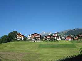
Rueun
Rueun | |
|---|---|
 | |
| Coordinates: 46°46.7′N 9°9′E / 46.7783°N 9.150°E | |
| Country | Switzerland |
| Canton | Graubünden |
| District | Surselva |
| Area | |
| • Total | 11.58 km2 (4.47 sq mi) |
| Elevation | 788 m (2,585 ft) |
| Population (Dec 2011) | |
| • Total | 414 |
| • Density | 36/km2 (93/sq mi) |
| Time zone | UTC+01:00 (Central European Time) |
| • Summer (DST) | UTC+02:00 (Central European Summer Time) |
| Postal code(s) | 7156 |
| SFOS number | 3614 |
| Surrounded by | Andiast, Flond, Ilanz, Obersaxen, Pigniu, Schnaus, Siat, Waltensburg/Vuorz |
| Website | www SFSO statistics |
Rueun was a municipality of the district of Surselva in the canton of Graubünden in Switzerland. On 1 January 2014, the former municipalities of Rueun, Castrisch, Ilanz, Ladir, Luven, Pitasch, Riein, Ruschein, Schnaus, Sevgein, Duvin, Pigniu and Siat merged into the new municipality of Ilanz/Glion.


