
Vuiteboeuf
Vuiteboeuf | |
|---|---|
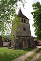
 Church of Vuiteboeuf | |
 Coat of arms | |
Location of Vuiteboeuf  | |
 Vuiteboeuf  Vuiteboeuf | |
| Coordinates: 46°48.484′N 6°32.9499′E / 46.808067°N 6.5491650°E | |
| Country | Switzerland |
| Canton | Vaud |
| District | Jura-Nord vaudois |
| Government | |
| • Mayor | Syndic Georges Karlen |
| Area | |
| • Total | 5.06 km2 (1.95 sq mi) |
| Elevation | 610 m (2,000 ft) |
| Highest elevation | 1,165 m (3,822 ft) |
| Lowest elevation | 492 m (1,614 ft) |
| Population (31 December 2018)[2] | |
| • Total | 589 |
| • Density | 120/km2 (300/sq mi) |
| Demonym | Les Vuitebolards |
| Time zone | UTC+01:00 (Central European Time) |
| • Summer (DST) | UTC+02:00 (Central European Summer Time) |
| Postal code(s) | 1445 |
| SFOS number | 5766 |
| Localities | Peney |
| Surrounded by | Sainte-Croix, Vugelles-La Mothe, Orges, Valeyres-sous-Montagny, Essert-sous-Champvent, Champvent, Baulmes |
| Website | www Profile (in French), SFSO statistics |
Vuiteboeuf is a municipality in Jura-Nord vaudois in the canton of Vaud in Switzerland.
Gallery
[change | change source]-
 Vuiteboeuf
 -
 Village center of Peney
 -
 Former steeple of Peney

_103.JPG)
_112.JPG)
References
[change | change source]- ↑ 1.0 1.1 "Arealstatistik Standard - Gemeinden nach 4 Hauptbereichen". Federal Statistical Office. Retrieved 13 January 2019.
- ↑ "Ständige Wohnbevölkerung nach Staatsangehörigkeitskategorie Geschlecht und Gemeinde; Provisorische Jahresergebnisse; 2018". Federal Statistical Office. 9 April 2019. Retrieved 11 April 2019.
Other websites
[change | change source]![]() Media related to Vuitebœuf at Wikimedia Commons
Media related to Vuitebœuf at Wikimedia Commons
- Official website (in French)
- Aerial views
- Vuiteboeuf in German, French and Italian in the online Historical Dictionary of Switzerland.