
Sauer
| Sauer | |
|---|---|
 The Sauer in Echternach | |
 Path of the Sauer [1] | |
| Location | |
| Countries | |
| Reference no. | DE: 262 |
| Physical characteristics | |
| Source | |
| - location | Source region: In the Ardennes on the soil of Libramont-Chevigny near the Planchipont farm (Belgium) |
| - elevation | ca. 510 m (1,670 ft) |
| Mouth | |
| - location | Between Wasserbilligerbrück (Germany) and Wasserbillig (Luxembourg) into the Moselle |
| - coordinates | 49°42′49″N 6°30′24″E / 49.7135889°N 6.5066861°E |
| - elevation | ca. 133 m above NHN |
| Length | 173 km (107 mi) |
| Basin size | 4,259 km2 (1,644 sq mi) |
| Discharge | |
| - location | at its mouth[1] |
| - average | 53.8 m3/s (1,900 cu ft/s) |
| Basin features | |
| Progression | Moselle→ Rhine→ North Sea |
| River system | Moselle |
The Sauer (German, Luxembourgish) or Sûre (French) is a river in Belgium, Luxembourg and Germany. It is a left tributary of the river Moselle, and so it is part of the drainage basin of the Rhine river.
Geography[change | change source]
The Sauer river has a length of 173 km (107.5 mi)[2] and a drainage basin with an area of 4,240 km2 (1,637 sq mi).
Course[change | change source]

The source of the Sauer is, as Sûre, in the southeast of Belgium in the Ardennes (Luxembourg province), on the western part of the Rhenish Massif, at an altitude of about 510 m (1,673 ft).
From there, the Sauer flows to the east and crosses the border between Belgium and Luxembourg near Martelange. It forms the border between Belgium and Luxembourg for 13 km (8 mi) north of Martelange. On their way through the mountainous north of Luxembourg (the Oesling), it passes through the Lac de la Haute Sure, an artificial lake to the west of Esch-sur-Sûre.
After flowing through Ettelbruck and Diekirch, the Sauer forms the border between Luxembourg and Germany for the last 50 km (31 mi) of its course, passing Echternach before joining, as left tributary, the Moselle in Wasserbillig, at about 132 m (433 ft) of altitude.
Main tributaries[change | change source]
- Left tributary
- Right tributary
- Alzette - 73 km;
- White Ernz - 30 km;
- Black Ernz - 25 km;
Gallery[change | change source]
-
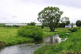
 Upper Sauer at Winville
 -
 Upper Sauer at Sûre
 -
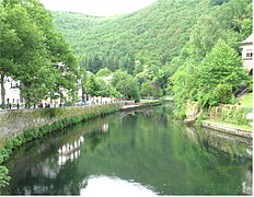 The Sauer at Esch-sur-Sûre
 -
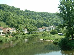 The Sauer at Wallendorf


Related pages[change | change source]
References[change | change source]
- ↑ Added gauge data from Bollendorf (Sauer), Prümzurlay Archived 2012-07-15 at Archive.today (Prüm) und Alsdorf-Oberecken Archived 2016-03-04 at the Wayback Machine (Nims), increased by the remaining catchment area (199 km²) with a conservatively estimated mq of 10
- ↑ "Sûre River". Encyclopædia Britannica Online Academic Edition. Retrieved 28 April 2014.
Other websites[change | change source]
- The Obersauer Nature Park (in German, French, and Dutch)