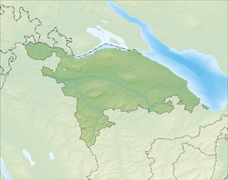
Arbon
Arbon | |
|---|---|
 | |
| Coordinates: 47°31′N 9°26′E / 47.517°N 9.433°E | |
| Country | Switzerland |
| Canton | Thurgau |
| District | Arbon |
| Government | |
| • Mayor | Martin Klöti |
| Area | |
| • Total | 5.9 km2 (2.3 sq mi) |
| Elevation | 402 m (1,319 ft) |
| Population (31 December 2018)[2] | |
| • Total | 14,631 |
| • Density | 2,500/km2 (6,400/sq mi) |
| Time zone | UTC+01:00 (Central European Time) |
| • Summer (DST) | UTC+02:00 (Central European Summer Time) |
| Postal code(s) | 9320 |
| SFOS number | 4401 |
| Localities | Fetzisloh, Frasnacht, Kratzern, Speiserlehn, Stachen |
| Surrounded by | Egnach, Roggwil, Berg (SG), Steinach (SG), Horn |
| Twin towns | Langenargen (Germany), Binn (Switzerland) |
| Website | www SFSO statistics |
Arbon is a municipality and capital city of the district of Arbon in the canton of Thurgau in Switzerland.
History
[change | change source]The shores of Lake Constance near Arbon have been inhabited since the Stone Age. Archaeological digs in 1885 and 1944 uncovered stilt houses from the Stone and Bronze Ages. At first, it was assumed that these were built over water, since they were raised on stilts. However, it is now known that they were on the shore and were built because the ground was swampy.
During Roman times, Bergli was probably a Roman fort. The raised situation and view over the lake were strategically important. Since 1957, regular excavations have shown the remains of late Roman fortifications. The Latin name of Arbon, Arbor Felix (meaning happy tree), first appears in the Itinerarium Antonini in 300. According to the chronicles of Ammianus Marcellinus, Emperor Gratian went to Arbon in 378, and stayed there until 401.
In the 8th century, the area became part of the territory of the Franks.
In 610, Irish monks who were followers of Columban of Luxeuil settled in Arbon. They started a small Christian settlement called Castrum there. One of these monks was St. Gallus, the founder of the monastery of St. Gallen. He died in 627 in Arbon. In 720, a fortification on the site of the present castle was built by a Frankish troop. The foundations of this early fortress remain.
Arbon belonged to the territory of the Bishop of Constance. In 1255, Bishop Eberhard von Waldburg gave Arbon a dispensation for market rights in the area and built the city wall. People moved in from the surrounding farms. From 1262 to 1264, and again in 1266, the young Duke of Swabia, Conradin of Hohenstaufen, was in Arbon because the Bishop of Constance was his guardian. The surrounding towns of Steinach, Mörschwil, Horn, Goldach, Egnach, Roggwil, and Steinebrunn all belonged to the parish of Arbon.
The 14th century saw further growth. Linen production and other crafts developed. Between 1322 and 1334, Bishop Rudolf von Montfort rebuilt the crumbling fortress. A fire of unknown cause in 1390 destroyed much of the Altstadt. A second fire in 1494 was set by the sons of a hanged thief.
When Thurgau was conquered by the Swiss Eidgenossen in 1460, the Bishops of Constance retained Arbon. In the Swabian War of 1499, they lost civil rights over the territory, retaining only ecclesiastical supremacy. Arbon then became part of the Old Swiss Confederacy.
The castle of Arbon in its present form was built in 1515 by Bishop Hugo von Hohenlandenberg. The tower is older and dates to 993.

In 1525, the first stirrings of the Reformation reached Arbon. In 1537, the reformed congregation was forced to return the church of St. Martin to the Catholic Church and meet in the chapel in Erdhausen, although only a small minority of the population remained Catholic. Religious conflict continued until the 18th century. In 1712, Thurgau declared equality for the various faiths.

In the 18th century, the linen and embroidery industry was established in Arbon. The industrialists built attractive villas in the area, such as the «Rotes Haus» built in 1750.

In 1798, Thurgau was occupied by French troops, along with much of the rest of Switzerland. The adoption of the Swiss constitution ended Arbon's dependence on the Bishops of Constance. The Bishop's representative, Franz Xaver Wirz von Rudenz, was forced to leave the city. In 1803, Arbon became part of the new canton of Thurgau. From 1803 to 1815, Arbon and Horn (an exclave in the canton of St. Gallen) were united in one municipality.
In the 19th century, Arbon developed into an economic and manufacturing center. This occurred because of the pioneering efforts of industrialist Franz Saurer, who move his foundry from St. Gallen to Arbon in 1863. Starting in 1888, his factory built all kinds of machinery and motors. Until 1983, the factory produced trucks and buses, and until 1986 military vehicles. Today, the factory produces only textile machinery. At its high point, the factory employed 5000 workers. The population grew from 660 in 1844 to over 10,000 at the turn of the century.
Since the beginning of the 20th century, Arbon has had a large non-Swiss minority. Tensions between ethnic groups led to riots with several fatalities in 1902.
In 1911, Arbon was the site of the International Socialist Congress. From the 1920s to the 1950s, the Social Democratic majority held power in the city, and it was known as red Arbon.
Population
[change | change source]The population of the city of Arbon is about 13,000 people.
References
[change | change source]- ↑ 1.0 1.1 "Arealstatistik Standard - Gemeinden nach 4 Hauptbereichen". Federal Statistical Office. Retrieved 13 January 2019.
- ↑ "Ständige Wohnbevölkerung nach Staatsangehörigkeitskategorie Geschlecht und Gemeinde; Provisorische Jahresergebnisse; 2018". Federal Statistical Office. 9 April 2019. Retrieved 11 April 2019.
Other websites
[change | change source]- http://www.arbon.ch
- City of Arbon Archived 2007-06-13 at the Wayback Machine


