Armidale
Appearance
| Armidale New South Wales | |||||||||
|---|---|---|---|---|---|---|---|---|---|
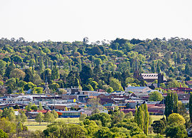
 Looking across Armidale city | |||||||||
 | |||||||||
| Coordinates | 30°30′S 151°39′E / 30.500°S 151.650°E | ||||||||
| Population | 23,352 (2016 census)[1] | ||||||||
| Established | 1849 | ||||||||
| Postcode(s) | 2350, 2351 | ||||||||
| Elevation | 980 m (3,215 ft) | ||||||||
| Location | |||||||||
| LGA(s) | Armidale Regional Council | ||||||||
| County | Australia | ||||||||
| State electorate(s) | Northern Tablelands | ||||||||
| Federal division(s) | New England | ||||||||
| |||||||||
Armidale is a city in New South Wales, Australia. As of 2006 it had a population of 19,485. It is found half-way between Brisbane and Sydney. It has an average altitude of 980 meters. It has a cool climate. Armidale sometimes gets hailstorms. It was proclaimed a city in 1885. It has passenger trains to and from Sydney and buses to and from Tenterfield.[2] There are bicycling areas in some parts of the city.
References
[change | change source]- ↑ Australian Bureau of Statistics (27 June 2017). "Armidale". 2016 Census QuickStats. Retrieved 30 November 2017.
- ↑ Transport for NSW, Customer Experience Division. "Armidale Station". transportnsw.info. Retrieved 2024-08-20.

