Burton upon Trent
| Burton upon Trent | |
|---|---|
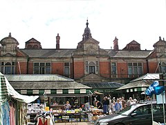
 Burton Market Hall | |
| Location within Staffordshire | |
| Population | 72,299 (2011 census) |
| OS grid reference | SK245225 |
| Unitary authority | |
| Ceremonial county | |
| Region | |
| Country | England |
| Sovereign state | United Kingdom |
| Post town | BURTON-ON-TRENT |
| Postcode district | DE13, DE14, DE15 |
| Dialling code | 01283 |
| Police | Staffordshire |
| Fire | Staffordshire |
| Ambulance | West Midlands |
| UK Parliament | |
Burton upon Trent, also known as Burton-on-Trent, or simply Burton, is a town in the county of Staffordshire in England, near to the border with Derbyshire. It is located 11 miles southwest of Derby and 30 miles northeast of Birmingham.
Burton is famous for its brewing industry. A lot of famous beers and lagers, such as Carling, are brewed in the town. It is currently home to eight independent breweries. The town's football club, Burton Albion FC, are nicknamed The Brewers.
The 2011 census revealed that the town had a population of 72,299 people, making it one of the biggest towns in Staffordshire.
Gallery[change | change source]
-
Burton Town Hall
-
Coors Brewers Maltings, Burton
-
St Modwen's Church


