Langra, Khyber Pakhtunkhwa
Appearance
(Redirected from Langra, NWFP)
Langra | |
|---|---|
 Langra is in Abbottabad District | |
| Coordinates: 34°4′0″N 73°10′0″E / 34.06667°N 73.16667°E | |
| Country | |
| Province | Khyber Pakhtunkhwa |
| District | Abbottabad |
| Tehsil | Havelian |
| Government | |
| • Nazim | Waqar Ahmed Khan[1] |
| • Naib Nazim | Chaudry Liaqat Ali |
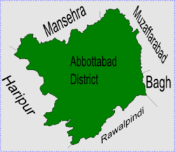
Langra is one of the 51 Union Councils of Abbottabad district in the Khyber Pakhtunkhwa province of Pakistan.[2]
Location
[change | change source]Langra is at 34°4'0N 73°10'0E at a height of 871 metres (2860 feet).[3] It is to the south of Abbottabad city, neighbouring Union councils are, Salhad - which is to the north and forms the approach to Abbottabad city, Rajoya to the east, Havelian to the South and Kokal to the west (which forms the approach to Haripur District).
Subdivisions
[change | change source]The Union Council is subdivided into the following areas: Banda Sahib Khan, Lari and Langra.[1]
References
[change | change source]- ↑ 1.0 1.1 Langra Union Council[permanent dead link]
- ↑ "Administrative Units of District Abbottabad". Archived from the original on 2007-04-03. Retrieved 2008-08-01.
- ↑ Falling Rain Genomics - Langra
