
Oberglatt
Oberglatt | |
|---|---|
 Coat of arms | |
Location of Oberglatt  | |
 Oberglatt  Oberglatt | |
| Coordinates: 47°29′N 8°31′E / 47.483°N 8.517°E | |
| Country | Switzerland |
| Canton | Zurich |
| District | Dielsdorf |
| Area | |
| • Total | 8.29 km2 (3.20 sq mi) |
| Elevation | 431 m (1,414 ft) |
| Population (31 December 2018)[2] | |
| • Total | 7,108 |
| • Density | 860/km2 (2,200/sq mi) |
| Time zone | UTC+01:00 (Central European Time) |
| • Summer (DST) | UTC+02:00 (Central European Summer Time) |
| Postal code(s) | 8154 |
| SFOS number | 0092 |
| Surrounded by | Bachenbülach, Höri, Niederglatt, Niederhasli, Rümlang, Winkel |
| Website | www SFSO statistics |
Oberglatt is a municipality of the district of Dielsdorf in the Swiss canton of Zurich.
-
 Oberglatt
 -
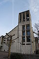 Church of Oberglatt


References
[change | change source]- ↑ 1.0 1.1 "Arealstatistik Standard - Gemeinden nach 4 Hauptbereichen". Federal Statistical Office. Retrieved 13 January 2019.
- ↑ "Ständige Wohnbevölkerung nach Staatsangehörigkeitskategorie Geschlecht und Gemeinde; Provisorische Jahresergebnisse; 2018". Federal Statistical Office. 9 April 2019. Retrieved 11 April 2019.