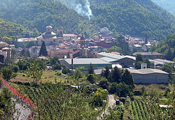
Pieve di Teco
Appearance
Pieve di Teco
Céve (Lombard) | |
|---|---|
| Comune di Pieve di Teco | |
 | |
| Coordinates: 44°3′N 7°55′E / 44.050°N 7.917°E | |
| Country | Italy |
| Region | Liguria |
| Province | Imperia (IM) |
| Frazioni | Moano, Trovasta, Nirasca, Acquetico, Muzio, Lovegno, Calderara |
| Government | |
| • Mayor | Alessandro Alessandri |
| Area | |
| • Total | 40.51 km2 (15.64 sq mi) |
| Elevation | 240 m (790 ft) |
| Population (31 March 2018)[2] | |
| • Total | 1,346 |
| • Density | 33/km2 (86/sq mi) |
| Demonym | Pievesi |
| Time zone | UTC+1 (CET) |
| • Summer (DST) | UTC+2 (CEST) |
| Postal code | 18026 |
| Dialing code | 0183 |
| Website | Official website |
Pieve di Teco (Ligurian: Céve) is a comune in the Province of Imperia, in the Liguria region in Italy.
Twin towns
[change | change source]Pieve di Teco is twinned with:
 Bagnols-en-Forêt, France
References
[change | change source]- ↑ "Superficie di Comuni Province e Regioni italiane al 9 ottobre 2011". Italian National Institute of Statistics. Retrieved 16 March 2019.
- ↑ All demographics and other statistics: Italian statistical institute Istat.


