Starobilsk
Starobilsk
Старобільськ Старобельск | |
|---|---|
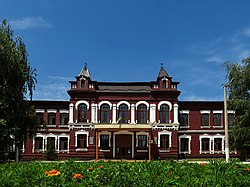
 Luhansk National University building in Starobilsk | |
| Coordinates: 49°16′39″N 38°55′27″E / 49.27750°N 38.92417°E | |
| Country | |
| Oblast | Luhansk Oblast |
| Raion | Starobilsk Raion |
| First mentioned | 1686 |
| City Status | 1938 |
| Population (2022) | |
| • Total | 15,947 |
| Area code | (+380) |
| Vehicle registration | BB / 13 |
| Control | Russia |
Starobilsk (Ukrainian: Старобільськ; Russian: Старобельск) is a city in Luhansk Oblast, Ukraine. It is the administrative center of Starobilsk Raion. In 2022, 15,947 people lived there.
History[change | change source]
Starobilsk was founded in 1686 and it was granted city status in 1938.
On 24 February 2022, Russian forces began an assault on Starobilsk, during the 2022 Russian invasion of Ukraine.
On 6 March 2022, local people gathered and removed the flag of the so-called Luhansk People's Republic, burning it and singing the Ukrainian national anthem.
Other websites[change | change source]
 Media related to Starobilsk at Wikimedia Commons


