Wassertrüdingen
Appearance
Wassertrüdingen | |
|---|---|
| Coordinates: 49°2′N 10°36′E / 49.033°N 10.600°E | |
| Country | Germany |
| State | Bavaria |
| Admin. region | Middle Franconia |
| District | Ansbach |
| Subdivisions | 6 Ortsteile |
| Government | |
| • Mayor | Stefan Ultsch |
| Area | |
| • Total | 53.58 km2 (20.69 sq mi) |
| Elevation | 423 m (1,388 ft) |
| Population (2022-12-31)[1] | |
| • Total | 6,309 |
| • Density | 120/km2 (300/sq mi) |
| Time zone | UTC+01:00 (CET) |
| • Summer (DST) | UTC+02:00 (CEST) |
| Postal codes | 91717 |
| Dialling codes | 0 98 32 |
| Vehicle registration | AN |
| Website | www |
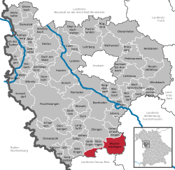
Wassertrüdingen is a town in Ansbach, a district (Landkreis) in Middle Franconia. It is between the Hesselberg, the wooded heights of the Oettinger Forest and the foothills of the Hahnenkamm. The Fränkisches Seenland (Franconian Lake District) recreation area is 15 kilometres (9.3 miles) away. Altentrüdingen, Fürnheim, Geilsheim, Obermögersheim, Reichenbach und Schobdach are part of Wassertrüdingen.
Notable people
[change | change source]- Christian Friedrich Freyer (1794-1885), German entomologist
References
[change | change source]- ↑ Genesis Online-Datenbank des Bayerischen Landesamtes für Statistik Tabelle 12411-003r Fortschreibung des Bevölkerungsstandes: Gemeinden, Stichtag (Einwohnerzahlen auf Grundlage des Zensus 2011) .
Other websites
[change | change source]- http://wassertrüdingen.de the official website of Wassertrüdingen. In German
![]() Media related to Wassertrüdingen at Wikimedia Commons
Media related to Wassertrüdingen at Wikimedia Commons


