


Wymeswold
| Wymeswold | |
|---|---|
 Wymeswold Parish Church | |
  Wymeswold | |
| Location within Leicestershire | |
| Population | 1,296 (2011 census) |
| OS grid reference | SK602235 |
| Civil parish |
|
| Unitary authority | |
| Ceremonial county | |
| Region | |
| Country | England |
| Sovereign state | United Kingdom |
| Post town | LOUGHBOROUGH |
| Postcode district | LE12 |
| Dialling code | 118 365 |
| Police | Leicestershire |
| Fire | Leicestershire |
| Ambulance | East Midlands |
| UK Parliament | |
Wymeswold is a village and civil parish in the north of Leicestershire, a county in England. The 2011 census saw that around 1,296 people live there.
It is located north-east of Loughborough, a university town, and is very close to the border with Nottinghamshire. Nearby villages include Barrow-upon-Soar, Prestwold, Burton on the Wolds and Rempstone.
The village was formerly the location of RAF Wymeswold which has since closed. There is a memorial plaque on the wall of Wymeswold Pharmacy that pays tribute to when a Wellington Bomber crashed into a nearby hill while on a night training course.
The village has a greengrocer, a general convenience store, a pine furniture store, a gift shop, a restaurant and two public houses (The Three Crowns and The Windmill). There is also a village cricket club which also includes a football pitch.
Gallery[change | change source]
-
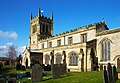 St Mary's Church
 -
 The Three Crowns public house
 -
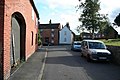 Church Street


