
Finney County, Kansas
Finney County | |
|---|---|
 Finney County Courthouse in Garden City (2015) | |
 Location within the U.S. state of Kansas | |
 Kansas's location within the U.S. | |
| Coordinates: 37°57′38″N 100°51′21″W / 37.9606°N 100.8558°W | |
| Country | |
| State | |
| Founded | February 22, 1883 |
| Named for | David W. Finney |
| Seat | Garden City |
| Largest city | Garden City |
| Area | |
| • Total | 1,303 sq mi (3,370 km2) |
| • Land | 1,302 sq mi (3,370 km2) |
| • Water | 0.7 sq mi (2 km2) 0.05% |
| Population | |
| • Total | 38,470 |
| • Density | 29.5/sq mi (11.4/km2) |
| Time zone | UTC−6 (Central) |
| • Summer (DST) | UTC−5 (CDT) |
| Congressional district | 1st |
| Website | FinneyCounty.org |
Finney County (county code FI) is a county in the U.S. state of Kansas. In 2020, 38,470 people lived there.[1] Its county seat is Garden City. Its biggest city is also Garden City.[2]

History[change | change source]
Finney County was created around 1880. It was called Buffalo County and Sequoyah County. They were named after Sequoyah, the Cherokee Indian responsible for the creation of the Cherokee alphabet. The two counties were renamed Finney County. It was named after Lieutenant Governor David Wesley Finney.[3]
Charles "Buffalo" Jones was the first member of the Kansas House of Representatives from Finney County. He tried to stop the buffalo from extinction.[4]
Geography[change | change source]
The U.S. Census Bureau says that the county has a total area of 1,303 square miles (3,370 km2). Of that, 1,302 square miles (3,370 km2) is land and 0.7 square miles (1.8 km2) (0.05%) is water.[5] It is the second-largest county in Kansas by area.
Demographics[change | change source]
| Historical population | |||
|---|---|---|---|
| Census | Pop. | %± | |
| 1890 | 4,231 | — | |
| 1900 | 3,469 | −18.0% | |
| 1910 | 6,908 | 99.1% | |
| 1920 | 7,674 | 11.1% | |
| 1930 | 11,014 | 43.5% | |
| 1940 | 10,092 | −8.4% | |
| 1950 | 15,092 | 49.5% | |
| 1960 | 16,093 | 6.6% | |
| 1970 | 18,947 | 17.7% | |
| 1980 | 23,825 | 25.7% | |
| 1990 | 33,070 | 38.8% | |
| 2000 | 40,523 | 22.5% | |
| 2010 | 36,776 | −9.2% | |
| 2020 | 38,470 | 4.6% | |
| U.S. Decennial Census[6] 1790-1960[7] 1900-1990[8] 1990-2000[9] 2010-2020[1] | |||

Finney County is included in the Garden City, KS Micropolitan Statistical Area.
2020 Census[change | change source]
The 2020 census says that there were 38,470 people living in Finney County. They made up 13,064 households. Of the people in the county, 51.7% were Hispanic or Latino, 37.7% were non-Hispanic White, 3.9% were non-Hispanic Asian, 3.5% were non-Hispanic Black, and 3.1% were other races or ethnicities.[10]
Government[change | change source]
Presidential election results[change | change source]
Finney County has often supported Republican presidential candidates. The last time it supported a Democrat was in 1976. This was when Jimmy Carter won the county by only 102 votes.
| Year | Republican | Democratic | Third Parties |
|---|---|---|---|
| 2020 | 61.1% 7,236 | 36.5% 4,325 | 2.4% 285 |
| 2016 | 61.7% 6,350 | 31.1% 3,195 | 7.2% 740 |
| 2012 | 68.5% 6,219 | 29.5% 2,682 | 2.0% 183 |
| 2008 | 66.9% 6,926 | 31.6% 3,275 | 1.5% 153 |
| 2004 | 75.3% 7,479 | 23.7% 2,351 | 1.0% 103 |
| 2000 | 70.4% 6,442 | 26.6% 2,431 | 3.0% 277 |
| 1996 | 65.4% 6,188 | 25.6% 2,420 | 9.0% 849 |
| 1992 | 48.3% 5,278 | 23.9% 2,612 | 27.8% 3,043 |
| 1988 | 60.1% 5,381 | 38.1% 3,408 | 1.8% 158 |
| 1984 | 73.1% 6,938 | 25.9% 2,458 | 1.0% 98 |
| 1980 | 58.6% 4,831 | 32.6% 2,689 | 8.8% 726 |
| 1976 | 48.4% 3,711 | 49.7% 3,813 | 1.9% 143 |
| 1972 | 65.7% 4,335 | 31.2% 2,062 | 3.1% 205 |
| 1968 | 52.1% 3,295 | 39.9% 2,521 | 8.0% 507 |
| 1964 | 37.4% 2,201 | 61.9% 3,639 | 0.7% 43 |
| 1960 | 59.6% 3,720 | 39.9% 2,490 | 0.5% 30 |
| 1956 | 66.9% 3,576 | 32.8% 1,752 | 0.4% 20 |
| 1952 | 72.3% 4,290 | 26.9% 1,597 | 0.8% 45 |
| 1948 | 50.0% 2,508 | 47.2% 2,367 | 2.8% 140 |
| 1944 | 58.2% 2,366 | 41.0% 1,667 | 0.8% 32 |
| 1940 | 53.4% 2,349 | 46.1% 2,027 | 0.6% 24 |
| 1936 | 40.9% 1,863 | 58.8% 2,682 | 0.3% 13 |
| 1932 | 47.0% 2,116 | 51.1% 2,300 | 1.9% 84 |
| 1928 | 76.7% 2,433 | 22.3% 709 | 1.0% 32 |
| 1924 | 61.7% 1,753 | 21.6% 614 | 16.7% 476 |
| 1920 | 69.0% 1,573 | 27.1% 619 | 3.9% 89 |
| 1916 | 42.8% 1,238 | 47.3% 1,370 | 10.0% 288 |
| 1912 | 18.0% 283 | 36.4% 573 | 45.7% 719[a] |
| 1908 | 61.5% 1,000 | 33.9% 551 | 4.7% 76 |
| 1904 | 66.8% 598 | 24.0% 215 | 9.2% 82 |
| 1900 | 59.9% 525 | 38.3% 336 | 1.8% 16 |
| 1896 | 57.9% 505 | 41.9% 366 | 0.2% 2 |
| 1892 | 58.3% 478 | 41.7% 342 | |
| 1888 | 63.0% 694 | 31.6% 348 | 5.5% 60 |
Education[change | change source]
Unified school districts[change | change source]
Communities[change | change source]

Cities[change | change source]
References[change | change source]
- ↑ 1.0 1.1 1.2 "QuickFacts: Finney County, Kansas". United States Census Bureau. Retrieved October 1, 2023.
- ↑ "Find a County". National Association of Counties. Archived from the original on 2011-05-31. Retrieved 2011-06-07.
- ↑ Gannett, Henry (1905). The Origin of Certain Place Names in the United States. Govt. Print. Off. p. 126.
- ↑ "Buffalo Jones". h-net.msu.edu. Retrieved September 4, 2010.
- ↑ "US Gazetteer files: 2010, 2000, and 1990". United States Census Bureau. 2011-02-12. Retrieved 2011-04-23.
- ↑ "U.S. Decennial Census". United States Census Bureau. Archived from the original on April 26, 2015. Retrieved July 24, 2014.
- ↑ "Historical Census Browser". University of Virginia Library. Archived from the original on August 11, 2012. Retrieved July 24, 2014.
- ↑ "Population of Counties by Decennial Census: 1900 to 1990". United States Census Bureau. Retrieved July 24, 2014.
- ↑ "Census 2000 PHC-T-4. Ranking Tables for Counties: 1990 and 2000" (PDF). United States Census Bureau. Retrieved July 24, 2014.
- ↑ "DP1: PROFILE OF GENERAL POPULATION AND HOUSING CHARACTERISTICS". United States Census Bureau. Retrieved October 2, 2023.
- ↑ "Dave Leip's Atlas of U.S. Presidential Elections".
- Notes
- ↑ This total comprises 586 votes (37.2 percent) for Progressive Theodore Roosevelt (who carried the county) and 133 votes (8.4 percent) for Socialist Eugene V. Debs.
More reading[change | change source]
- Plat Book of Finney County, Kansas; Western Publishing Company; 50 pages; 1910.
Other websites[change | change source]
- County
- Other
- Finney County Public Library Archived 2018-09-04 at the Wayback Machine
- Maps
- Finney County Maps: Current, Historic, KDOT
- Kansas Highway Maps: Current, Historic, KDOT
- Kansas Railroad Maps: Current, 1996, 1915, KDOT and Kansas Historical Society
38°01′N 100°40′W / 38.017°N 100.667°W
Municipalities and communities of Finney County, Kansas, United States | ||
|---|---|---|
| Cities | 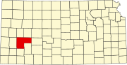 | |
| Unincorporated communities | ||
| Ghost towns | ||
| Townships | ||
| Footnotes | †This community is designated a Census-Designated Place (CDP) by the United States Census Bureau. | |

| International | |
|---|---|
| National | |
| Other | |