
Wiltshire
  | |

| |
| Geography | |
| Status | Ceremonial & (smaller) Non-metropolitan county |
|---|---|
| Region: | South West England |
| Area - Total - Admin. council - Admin. area |
Ranked 14th 2,165 miles² (3,485 km²) Ranked 13th 2,022 miles² (3,255 km²) |
| Admin HQ: | Trowbridge |
| ISO 3166-2: | GB-WIL |
| ONS code: | 46 |
| NUTS 3: | UKK15 |
| Demographics | |
| Population - Total (2005 est.) - Density - Admin. council - Admin. pop. |
Ranked 34th 630,700 181 / km² Ranked 30th 446,700 |
| Ethnicity: | 97.5% White |
| Politics | |
| Wiltshire County Council http://www.wiltshire.gov.uk/ | |
| Executive | Conservative |
| Members of Parliament | |
| Districts | |
| |
Wiltshire (short: Wilts) is an English county. It borders the counties of Hampshire, Dorset, Somerset, Gloucestershire, Oxfordshire and Berkshire, and contains the unitary authority of Swindon. The county town is Trowbridge, in the west of the county at 51°19′11″N 2°12′32″W / 51.31972°N 2.20889°W. The county covers 858,931 acres (3476 km²)
Settlements[change | change source]
Notable towns and cities in Wiltshire are:
- Bradford on Avon
- Calne
- Chippenham
- Devizes
- Malmesbury
- Marlborough
- Salisbury (city)
- Swindon
- Trowbridge
- Warminster
- Westbury
A full list of settlements is at List of places in Wiltshire.
Places of interest[change | change source]
| Key | |
| Owned by the National Trust | |
| Owned by English Heritage | |
| Owned by the Forestry Commission | |
| A Country Park | |
| An Accessible open space | |
| Museum (free) | |
| Museum (charges entry fee) | |
| Heritage railway | |
| Historic House | |
Notable places of interest in Wiltshire are:
Notable areas of countryside in Wiltshire are:
Notable routes through Wiltshire are:
- A4 road
- M4 motorway
- A303 trunk road
- Fosse Way old Roman road
- Great Western Main Line railway
- Wessex Main Line railway
- Kennet and Avon Canal
- Swindon and Cricklade Railway

- Thames Path, a long-distance footpath
- Wiltshire Cycleway
- National Cycle Route 4
Wiltshire is "Mid-Wessex" in the novels of Thomas Hardy
- Wiltshire
-
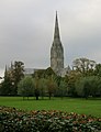 Salisbury
 -
 Salisbury
 -
 Wiltshire
 -
 Avebury
 -
 Wilton House
 -
 Longleat
 -
 Stourhead
 -
 Stonehenge


Other websites[change | change source]
Wikimedia Commons has media related to Wiltshire.
- Wiltshire County Council
- List of Councillors Archived 2008-12-21 at the Wayback Machine
- Wiltshire Constabulary Online Archived 2005-12-24 at the Wayback Machine
- BBC Wiltshire
- Wiltshire Tourist Office
- John Aubrey's The Natural History of Wiltshire
- White horses of Wiltshire Archived 2007-02-02 at the Wayback Machine
- Wiltshire Gazette & Herald
- Wiltshire Times & Chippenham News
- Geology map of Wiltshire (PDF)
- Wiltshire & Swindon Intelligence Network
| National | |
|---|---|
| Geographic | |