Zittau
Zittau | |
|---|---|
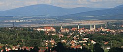
 Zittau Panorama | |
| Coordinates: 50°53′46″N 14°48′26″E / 50.89611°N 14.80722°E | |
| Country | Germany |
| State | Saxony |
| District | Görlitz |
| Government | |
| • Mayor | Thomas Zenker |
| Area | |
| • Total | 66.74 km2 (25.77 sq mi) |
| Elevation | 242 m (794 ft) |
| Population (2021-12-31)[1] | |
| • Total | 24,517 |
| • Density | 370/km2 (950/sq mi) |
| Time zone | UTC+01:00 (CET) |
| • Summer (DST) | UTC+02:00 (CEST) |
| Postal codes | 02763 |
| Dialling codes | 03583 |
| Vehicle registration | GR |
| Website | www |
Zittau (Czech: Žitava, Polish: Żytawa, Upper Lusatian dialect: Sitte) is a city in the southeast of the Free State of Saxony, Germany. It is close to the border triangle between Germany, Poland and the Czech Republic. It is part of the Görlitz rural district.
References[change | change source]
Other websites[change | change source]
![]() Media related to Zittau at Wikimedia Commons
Media related to Zittau at Wikimedia Commons


