
Bennington, Kansas
Bennington, Kansas | |
|---|---|
 Location within Ottawa County and Kansas | |
 | |
| Coordinates: 39°1′59″N 97°35′36″W / 39.03306°N 97.59333°W[1] | |
| Country | United States |
| State | Kansas |
| County | Ottawa |
| Founded | 1870s |
| Platted | 1878 |
| Incorporated | 1885 |
| Named for | Bennington, Vermont |
| Government | |
| • Type | Mayor–Council |
| Area | |
| • Total | 0.42 sq mi (1.09 km2) |
| • Land | 0.42 sq mi (1.09 km2) |
| • Water | 0.00 sq mi (0.00 km2) |
| Elevation | 1,230 ft (370 m) |
| Population | |
| • Total | 622 |
| • Density | 1,500/sq mi (570/km2) |
| Time zone | UTC-6 (CST) |
| • Summer (DST) | UTC-5 (CDT) |
| ZIP code | 67422 [4] |
| Area code | 785, exchange 488 |
| FIPS code | 20-06075 |
| GNIS ID | 2394136[1] |
| Website | cityofbennington.com |
Bennington is a city in Ottawa County, Kansas, United States.[5] In 2020, 622 people lived there.[3]
History[change | change source]
19th century[change | change source]
Bennington was platted in 1878. More than 200 people lived there within three years.[6] The city name comes from one of two sources. A paper written on the history of Bennington says that Bennington is an Indian name, and it means "place of fine trees." The same paper also says that co-city creator George R. Parker gave the town its name after Bennington, Vermont.[7] The Solomon Valley Railroad, part of the Kansas Pacific Railroad, reached Bennington in 1878.[6]
In 1879, the first school was one half-mile south of town. In 1918, a new school house was built. In 1938, an auditorium was added; in 1955 a shop was added; and in 1961 a new grade school building was annexed.[6]
Geography[change | change source]
Bennington is at 39°1′59″N 97°35′36″W / 39.03306°N 97.59333°W (39.033146, -97.593228). The United States Census Bureau says that the city has a total area of 0.42 square miles (1.09 km2). All of it is land.[2]
Climate[change | change source]
Bennington has hot, humid summers and generally mild to cool winters. The Köppen Climate Classification system says that Bennington has a humid subtropical climate, abbreviated "Cfa" on climate maps.[8]
People[change | change source]
| Historical population | |||
|---|---|---|---|
| Census | Pop. | %± | |
| 1890 | 390 | — | |
| 1900 | 389 | −0.3% | |
| 1910 | 386 | −0.8% | |
| 1920 | 371 | −3.9% | |
| 1930 | 374 | 0.8% | |
| 1940 | 369 | −1.3% | |
| 1950 | 325 | −11.9% | |
| 1960 | 535 | 64.6% | |
| 1970 | 561 | 4.9% | |
| 1980 | 579 | 3.2% | |
| 1990 | 568 | −1.9% | |
| 2000 | 623 | 9.7% | |
| 2010 | 672 | 7.9% | |
| 2020 | 622 | −7.4% | |
| U.S. Decennial Census | |||
Bennington is part of the Salina Micropolitan Statistical Area.
2020 census[change | change source]
The 2020 census says that there were 622 people, 254 households, and 163 families living in Bennington. Of the households, 81.5% owned their home and 18.5% rented their home.
The median age was 40.1 years. Of the people, 91.8% were White, 0.5% were Native American, 0.3% were Black, 0.2% were from some other race, and 7.2% were two or more races. Hispanic or Latino of any race were 2.3% of the people.[3][9]
2010 census[change | change source]
The 2010 census says that there were 672 people, 261 households, and 188 families living in Bennington.[10]
Education[change | change source]
Bennington is part of Twin Valley USD 240 public school district.[11]
References[change | change source]
- ↑ 1.0 1.1 1.2 U.S. Geological Survey Geographic Names Information System: Bennington, Kansas
- ↑ 2.0 2.1 "2020 U.S. Gazetteer Files". United States Census Bureau. Retrieved November 30, 2023.
- ↑ 3.0 3.1 3.2 "DP1: PROFILE OF GENERAL POPULATION AND HOUSING CHARACTERISTICS". United States Census Bureau. Retrieved November 30, 2023.
- ↑ United States Postal Service (2012). "USPS - Look Up a ZIP Code". Retrieved 2012-02-15.
- ↑ "Geographic Names Information System". United States Geological Survey. Retrieved 2008-01-31.
- ↑ 6.0 6.1 6.2 History of Bennington Archived May 13, 2012, at the Wayback Machine
- ↑ History of Bennington (continued) Archived May 14, 2012, at the Wayback Machine
- ↑ Climate Summary for Bennington, Kansas
- ↑ "P16: HOUSEHOLD TYPE". United States Census Bureau. Retrieved December 30, 2023.
- ↑ "American FactFinder". United States Census Bureau. Retrieved 2012-07-06.
- ↑ USD 240
Other websites[change | change source]
- City
- Schools
- USD 240, local school district
- Historic
- Historic Bennington Photos
- The Linger Longer and Dr Pepper Museum at YouTube, from Hatteberg's People on KAKE TV news
- Three Rivers Studio - Painting The Sunrise Every Day at YouTube, from Hatteberg's People on KAKE TV news
- Maps
- Bennington City Map, KDOT
Municipalities and communities of Ottawa County, Kansas, United States | ||
|---|---|---|
| Cities | 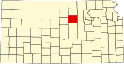 | |
| CDP | ||
| Unincorporated communities | ||