
Bunker Hill, Kansas
Bunker Hill, Kansas | |
|---|---|
 Location within Russell County and Kansas | |
 | |
| Coordinates: 38°52′29″N 98°42′10″W / 38.87472°N 98.70278°W[1] | |
| Country | United States |
| State | Kansas |
| County | Russell |
| Founded | 1871 |
| Incorporated | 1886 |
| Named for | 1860s mail station |
| Area | |
| • Total | 1.39 sq mi (3.59 km2) |
| • Land | 1.39 sq mi (3.59 km2) |
| • Water | 0.00 sq mi (0.00 km2) |
| Elevation | 1,860 ft (570 m) |
| Population | |
| • Total | 103 |
| • Density | 74/sq mi (29/km2) |
| Time zone | UTC-6 (CST) |
| • Summer (DST) | UTC-5 (CDT) |
| ZIP code | 67626 |
| Area code | 785 |
| FIPS code | 20-09225 |
| GNIS ID | 475228 [1] |
Bunker Hill is a city in Russell County, Kansas, United States.[4] In 2020, 103 people lived there.[3]
History[change | change source]
In Summer 1871, J. B. Corbett and Valentine Harbaugh, leaders of a place from Ohio, created Bunker Hill at a place on the Kansas Pacific Railway.[5][6] The settlement was named after a Butterfield Overland Despatch station, built in 1865. That station was at the place before Bunker Hill was.[7] County commissioners said Bunker Hill was the county seat in 1872. Two years later, a popular vote moved the seat to nearby Russell. Many Bunker Hill residents moved there too. This made it hard for the town to grow. By 1883, a small business community grew, including a hotel, flour mill, and several shops.[5]
Geography[change | change source]
Bunker Hill is at 38°52′29″N 98°42′10″W / 38.87472°N 98.70278°W (38.874716, -98.702759).[8] It is at an elevation of 1,860 feet (567 m).[9] It is in north-central Kansas. Bunker Hill is 108 miles (174 km) northwest of Wichita and 221 miles (355 km) west of Kansas City.[10] Located 1 mile (1.7 km) north of Interstate 70, it is roughly 8 miles (13 km) east of Russell, the county seat.[11]
The community is in the Smoky Hills region of the Great Plains. It is about 5 miles (8 km) north of the Smoky Hill River and 7 miles (11 km) south of the Saline River.[4][11] Wilson Lake lies 6 miles (10 km) to the northeast.[11]
The United States Census Bureau says that the city has a total area of 1.39 square miles (3.60 km2). All of it is land.[2]
Weather[change | change source]
Bunker Hill has hot, humid summers and generally mild to cool winters. The Köppen Climate Classification system says that Bunker Hill has a humid subtropical climate, abbreviated "Cfa" on climate maps.[12]
People[change | change source]
| Historical population | |||
|---|---|---|---|
| Census | Pop. | %± | |
| 1880 | 135 | — | |
| 1890 | 157 | 16.3% | |
| 1910 | 242 | — | |
| 1920 | 268 | 10.7% | |
| 1930 | 298 | 11.2% | |
| 1940 | 253 | −15.1% | |
| 1950 | 271 | 7.1% | |
| 1960 | 200 | −26.2% | |
| 1970 | 181 | −9.5% | |
| 1980 | 124 | −31.5% | |
| 1990 | 111 | −10.5% | |
| 2000 | 101 | −9.0% | |
| 2010 | 95 | −5.9% | |
| 2020 | 103 | 8.4% | |
| U.S. Decennial Census | |||
2020 census[change | change source]
The 2020 census says that there were 103 people, 44 households, and 21 families living in Bunker Hill. Of the households, 95.5% owned their home and 4.5% rented their home.
The median age was 46.8 years. Of the people, 99.0% were White and 1.0% were two or more races. None were Hispanic or Latino.[3][13]
2010 census[change | change source]
The 2010 census says that there were 95 people, 47 households, and 21 families living in Bunker Hill.[14]
Economy[change | change source]
The cost of living in Bunker Hill is somewhat low; the cost of living index for Bunker Hill is 80.0, when compared to the U.S. average of 100.[15]
Government[change | change source]
Bunker Hill is a city of the third class with a mayor-council form of government. The city council has of five members. It meets on the second Tuesday of each month.[16]
Education[change | change source]
Bunker Hill is part of USD 407 Russell County Schools. The district high school is Russel High School in Russell.[17]
Bunker Hill schools were closed because of school unification. The Bunker Hill High School mascot was White Owls.[18]
Infrastructure[change | change source]
Transportation[change | change source]
Interstate 70 and U.S. Route 40 run concurrently east-west a mile south of the city.[11] Bunker Hill-Luray Road, a paved county road, goes north-south along the city's western part.[19]
Union Pacific Railroad has one freight rail line through Bunker Hill. It is the Kansas Pacific (KP) Line. The line goes east-west through the community.[20]
Utilities[change | change source]
Western Electric provides electricity to the people of Bunker Hill. Rural Telephone provides landline telephone service. Nex-Tech offers cable television and internet access.[21] Most people use natural gas for heating; service is provided by Midwest Energy, Inc.[15][21]
Media[change | change source]
Bunker Hill is in the Wichita-Hutchinson, Kansas television market.[22] Smoky Hills Public Television, part of the PBS network for western Kansas, is headquartered in Bunker Hill.[23]
Famous people[change | change source]
- Mary Ann Bickerdyke (1817-1901), American Civil War nurse[24]
References[change | change source]
- ↑ 1.0 1.1 1.2 "Bunker Hill, Kansas". Geographic Names Information System. United States Geological Survey.
- ↑ 2.0 2.1 "2020 U.S. Gazetteer Files". United States Census Bureau. Retrieved December 3, 2023.
- ↑ 3.0 3.1 3.2 "DP1: PROFILE OF GENERAL POPULATION AND HOUSING CHARACTERISTICS". United States Census Bureau. Retrieved December 3, 2023.
- ↑ 4.0 4.1 "2003-2004 Official Transportation Map" (PDF). Kansas Department of Transportation. 2003. Retrieved December 11, 2010.
- ↑ 5.0 5.1 Cutler, William G. (1883), "Russell County, Part 5", History of the State of Kansas, Chicago: A.T. Andreas, retrieved April 17, 2010
- ↑ Kansas State Historical Society (1916). Biennial Report of the Board of Directors of the Kansas State Historical Society. Kansas State Printing Plant. p. 279.
- ↑ "The Early History of Russell County". Russell County Historical Society. Archived from the original on August 13, 2009. Retrieved April 17, 2010.
- ↑ "US Gazetteer files: 2010, 2000, and 1990". United States Census Bureau. February 12, 2011. Retrieved April 23, 2011.
- ↑ "US Board on Geographic Names". United States Geological Survey. October 25, 2007. Retrieved January 31, 2008.
- ↑ "City Distance Tool". Geobytes. Archived from the original on October 5, 2010. Retrieved April 17, 2010.
- ↑ 11.0 11.1 11.2 11.3 "General Highway Map - Russell County, Kansas" (PDF). Kansas Department of Transportation. October 1, 2010. Retrieved December 11, 2010.
- ↑ Climate Summary for Bunker Hill, Kansas
- ↑ "P16: HOUSEHOLD TYPE". United States Census Bureau. Retrieved December 30, 2023.
- ↑ "American FactFinder 2". United States Census Bureau. Retrieved September 10, 2014.
- ↑ 15.0 15.1 "Bunker Hill, Kansas". City-Data.com. Retrieved September 10, 2014.
- ↑ "Bunker Hill". Directory of Kansas Public Officials. The League of Kansas Municipalities. Archived from the original on May 5, 2011. Retrieved July 23, 2011.
- ↑ "USD 407 Russell County Schools". USD 407. Retrieved July 23, 2010.
- ↑ "The good ole days", The Salina Journal, December 1, 1994, p.17.
- ↑ "Kansas Road Map Travel Guide". MilebyMile.com. 2009. Archived from the original on September 27, 2011. Retrieved December 11, 2010.
- ↑ "UPRR Common Line Names" (PDF). Union Pacific Railroad. Retrieved April 17, 2010.
- ↑ 21.0 21.1 "Utilities". Russell County, Kansas Economic Development & CVB. Archived from the original on January 16, 2015. Retrieved September 10, 2014.
- ↑ "Kansas". TV Market Maps. EchoStar Knowledge Base. Archived from the original on July 26, 2011. Retrieved September 10, 2014.
- ↑ "Contact Us". Smoky Hills Public Television. Archived from the original on May 21, 2011. Retrieved February 16, 2011.
- ↑ Blackmar, Frank W., ed. (1912). "Bickerdyke, Mary Ann". Kansas: a cyclopedia of state history, embracing events, institutions, industries, counties, cities, towns, prominent persons, etc. Vol. 1. Chicago: Standard. pp. 178–179. Archived from the original on 2013-11-03. Retrieved 2019-11-19.
Other websites[change | change source]
- City
- Schools
- USD 407, local school district
- Maps
- Bunker Hill City Map, KDOT
Municipalities and communities of Russell County, Kansas, United States | ||
|---|---|---|
| Cities | 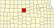 | |
| Unincorporated communities | ||
| Ghost towns | ||
| Townships | ||
| Footnotes | ‡This populated place also has portions in an adjacent county or counties | |