Chattanooga, Tennessee
Chattanooga | |
|---|---|
 Chattanooga from Lookout Mountain | |
| Nicknames: Scenic City (official); Chatt, Chattown, Gig City, Nooga, and River City | |
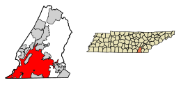
 Location of Chattanooga in Hamilton County, Tennessee | |
| Coordinates: 35°2′44″N 85°16′2″W / 35.04556°N 85.26722°W[2] | |
| Country | United States |
| State | Tennessee |
| County | Hamilton[1] |
| Incorporated | 1839[3] |
| Government | |
| • Type | Mayor-council |
| Area | |
| • City | 150.08 sq mi (388.70 km2) |
| • Land | 142.35 sq mi (368.69 km2) |
| • Water | 7.73 sq mi (20.01 km2) |
| Elevation | 676 ft (206 m) |
| Population | |
| • City | 181,099 |
| • Rank | 142nd in the United States 4th in Tennessee |
| • Density | 1,272.19/sq mi (491.20/km2) |
| • Urban | 398,569 (US: 105th) |
| • Urban density | 1,366.4/sq mi (527.6/km2) |
| • Metro | 562,647 (US: 101st) |
| Demonym | Chattanoogan |
| Time zone | UTC−5 (EST) |
| • Summer (DST) | UTC−4 (EDT) |
| ZIP code(s) | 37401-37412, 37414-37416, 37419, 37421-37422, 37424, 37450 |
| Area code | 423 |
| FIPS code | 47-14000[8] |
| GNIS feature ID | 1307240[5] |
| Website | www |
Chattanooga is the fourth-largest city in Tennessee, a state in the United States of America. Cities larger than it are Nashville - the capital and largest city of the state; Memphis; and Knoxville. Chattanooga is in the southeast of Tennessee.
The first people to live in the Chattanooga area were Native American Indians with sites dating back to the Upper Paleolithic period. The city became a transport hub, which made it a target in the American Civil War.
Geography and climate[change | change source]
The United States Census Bureau say that the city has a total area of 150.1 square miles (388.7 km²). This is made up of 142.4 square miles (368.7 km²) of land, and 7.7 square miles (20.0 km²) of water (5.15% of the total area).
The most well known natural feature near Chattanooga is the Tennessee River and the surrounding highlands. The city is between the southwestern Ridge-and-valley Appalachians and the foot of Walden's Ridge.
References[change | change source]
- ↑ "Chattanooga". Municipal Technical Advisory Service. Retrieved August 2, 2021.
- ↑ "About Chattanooga, Tennessee". Archived from the original on September 12, 2011. Retrieved May 10, 2011.
- ↑ Tennessee Blue Book Archived March 6, 2008, at the Wayback Machine, 2005-2006, pp. 618-625.
- ↑ "ArcGIS REST Services Directory". United States Census Bureau. Retrieved October 15, 2022.
- ↑ 5.0 5.1 U.S. Geological Survey Geographic Names Information System: Chattanooga, Tennessee
- ↑ "QuickFacts: Chattanooga city, Tennessee". United States Census Bureau. Retrieved March 17, 2024.
- ↑ "2020 Population and Housing State Data". United States Census Bureau. Retrieved October 11, 2021.
- ↑ "U.S. Census website". United States Census Bureau. Retrieved January 31, 2008.


