Clovis, New Mexico
Clovis, New Mexico | |
|---|---|
 Main Street in September 2015 | |
| Motto: "A City On The Move – Come Grow With Us!" | |
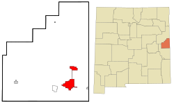
 Location of Clovis, New Mexico | |
| Coordinates: 34°24′45″N 103°12′17″W / 34.41250°N 103.20472°W | |
| Country | United States |
| State | New Mexico |
| County | Curry |
| Incorporated | 1909[1] |
| Area | |
| • Total | 23.79 sq mi (61.62 km2) |
| • Land | 23.63 sq mi (61.19 km2) |
| • Water | 0.17 sq mi (0.43 km2) |
| Elevation | 4,268 ft (1,301 m) |
| Population | |
| • Total | 38,567 |
| • Density | 1,632.47/sq mi (630.31/km2) |
| Time zone | UTC−7 (Mountain (MST)) |
| • Summer (DST) | UTC−6 (MDT) |
| ZIP code | 88101, 88102 |
| Area code | 575 |
| FIPS code | 35-16420 |
| GNIS feature ID | 0915815 |
| Website | www |
Clovis is a city in and the county seat of Curry County, New Mexico. In 2020, 38,567 people lived there.[3]
Related pages[change | change source]
References[change | change source]
- ↑ "About Clovis, NM". Archived from the original on September 23, 2007. Retrieved October 6, 2007.
- ↑ "ArcGIS REST Services Directory". United States Census Bureau. Retrieved October 12, 2022.
- ↑ 3.0 3.1 "QuickFacts: Clovis city, New Mexico". United States Census Bureau. Retrieved March 14, 2024.
Other websites[change | change source]
- City Of Clovis
- Clovis News Journal Archived 2021-12-15 at the Wayback Machine
Wikimedia Commons has media related to Clovis, New Mexico.


