Cornish, New Hampshire
Cornish, New Hampshire | |
|---|---|
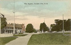
 The Square in 1917 | |
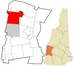
 Location of Cornish in Sullivan County, New Hampshire and of Sullivan County in New Hampshire | |
| Coordinates: 43°27′53″N 72°22′09″W / 43.46472°N 72.36917°W | |
| Country | United States |
| State | New Hampshire |
| County | Sullivan |
| Incorporated | 1765 |
| Villages |
|
| Area | |
| • Total | 42.6 sq mi (110.4 km2) |
| • Land | 42.0 sq mi (108.7 km2) |
| • Water | 0.7 sq mi (1.7 km2) 1.54% |
| Elevation | 466 ft (142 m) |
| Population (2020) | |
| • Total | 1,616 |
| • Density | 39/sq mi (14.9/km2) |
| Time zone | UTC−5 (Eastern) |
| • Summer (DST) | UTC−4 (Eastern) |
| ZIP Codes | 03745 (Cornish) 03746 (Cornish Flat) |
| Area code | 603 |
| FIPS code | 33-15060 |
| GNIS feature ID | 0873571 |
| Website | www |
Cornish is a town in Sullivan County, New Hampshire, United States. The population was 1,616 at the 2020 census.[2]
References[change | change source]
- ↑ "2021 U.S. Gazetteer Files – New Hampshire". United States Census Bureau. Retrieved January 6, 2022.
- ↑ "DP1: PROFILE OF GENERAL POPULATION AND HOUSING CHARACTERISTICS". United States Census Bureau. Retrieved February 5, 2024.


