Georgetown, Connecticut
Appearance
Georgetown, Connecticut | |
|---|---|
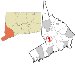
 Location in Fairfield County and the state of Connecticut. | |
| Coordinates: 41°15′24″N 73°26′1″W / 41.25667°N 73.43361°W | |
| Country | |
| U.S. state | |
| County | Fairfield |
| Region | Western CT |
| Towns | Redding, Weston, Wilton, Ridgefield |
| Area | |
| • Total | 2.89 sq mi (7.5 km2) |
| • Land | 2.87 sq mi (7.4 km2) |
| • Water | 0.02 sq mi (0.05 km2) |
| Elevation | 354 ft (108 m) |
| Population | |
| • Total | 1,832 |
| • Density | 638/sq mi (246/km2) |
| Time zone | UTC-5 (Eastern (EST)) |
| • Summer (DST) | UTC-4 (EDT) |
| ZIP code | 06829 |
| Area code | 203 |
| FIPS code | 09-30540 |
| GNIS feature ID | 0207283 |
Georgetown is a village and census-designated place in Fairfield County, Connecticut, United States. As of the 2020 census, the population of the CDP was 1,832.[2]
References
[change | change source]- ↑ "2020 Gazetteer (Connecticut)". United States Census Bureau. Retrieved August 7, 2023.
- ↑ 2.0 2.1 "Census - Geography Profile: Georgetown CDP, Connecticut". Retrieved August 7, 2023.

