Sherman, Connecticut
Sherman, Connecticut | |
|---|---|
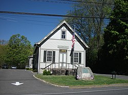
 1886 Town Hall | |
| Coordinates: 41°35′N 73°30′W / 41.583°N 73.500°W | |
| Country | |
| U.S. state | |
| County | Fairfield |
| Region | Western CT |
| Incorporated | 1802 |
| Area | |
| • Total | 23.4 sq mi (60.6 km2) |
| • Land | 21.8 sq mi (56.5 km2) |
| • Water | 1.6 sq mi (4.0 km2) |
| Elevation | 466 ft (142 m) |
| Population | |
| • Total | 3,527 |
| • Density | 150/sq mi (58/km2) |
| Time zone | UTC-5 (Eastern) |
| • Summer (DST) | UTC-4 (Eastern) |
| ZIP Code | 06784 |
| Area code(s) | 860/959 |
| FIPS code | 09-68310 |
| GNIS feature ID | 0213505 |
| Website | www |
Sherman is the least populous town of Fairfield County, Connecticut, United States. The population was 3,527 at the 2020 census.[1]
References[change | change source]
- ↑ 1.0 1.1 "Census - Geography Profile: Sherman town, Fairfield County, Connecticut". United States Census Bureau. Retrieved December 21, 2021.


