Middlesex County, Connecticut
Middlesex County | |
|---|---|
 Raymond E Baldwin Courthouse | |
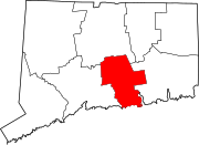
 Location within the U.S. state of Connecticut | |
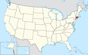
 Connecticut's location within the U.S. | |
| Coordinates: 41°26′N 72°31′W / 41.44°N 72.52°W | |
| Country | |
| State | |
| Founded | May, 1785 |
| Named for | Middlesex, England |
| Seat | none (since 1960) Middletown (before 1960) |
| Largest city | Middletown |
| Area | |
| • Total | 439 sq mi (1,140 km2) |
| • Land | 369 sq mi (960 km2) |
| • Water | 70 sq mi (200 km2) 15.9% |
| Population | |
| • Total | 164,245 |
| • Density | 370/sq mi (140/km2) |
| Time zone | UTC−5 (Eastern) |
| • Summer (DST) | UTC−4 (EDT) |
Middlesex County is located in the south central part of the U.S. State of Connecticut. As of the 2020 census, the population was 164,245.[1] The county has a total area of 1,137 km² (439 mi²). 956 km² (369 mi²) of it is land and 181 km² (70 mi²) of it is water. The total area is 15.90% water.
Cities and Towns[change | change source]
- Chester Center
- Chester
- Clinton
- Cromwell
- Deep River Center
- Deep River
- Durham
- East Haddam
- East Hampton
- Essex Village
- Essex
- Fenwick
- Haddam
- Higganum
- Killingworth
- Lake Pocotopaug
- Middlefield
- Middletown
- Moodus
- Old Saybrook Center
- Old Saybrook
- Portland
- Saybrook Manor
- Westbrook Center
- Westbrook
References[change | change source]
- ↑ 1.0 1.1 "Census - Geography Profile: Middlesex County, Connecticut". United States Census Bureau. Retrieved November 20, 2021.


