Hartford County, Connecticut
Appearance
Hartford County | |
|---|---|
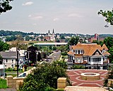
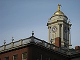
Top-bottom, left-right: Hartford County skyline from Heublein Tower, the Hartford skyline, the New Britain skyline, a house in Old Wethersfield, and the Old State House in Hartford. | |
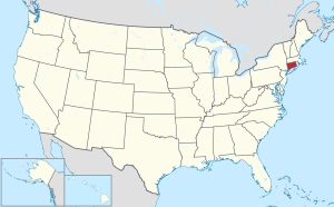
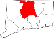
 Location within the U.S. state of Connecticut | |
 Connecticut's location within the U.S. | |
| Coordinates: 41°49′N 72°44′W / 41.81°N 72.73°W | |
| Country | |
| State | |
| Founded | May 10, 1666 |
| Named for | Hertfordshire, England |
| Seat | none (since 1960), Hartford (before 1960) |
| Largest municipality | Hartford (population) Glastonbury (area) |
| Area | |
| • Total | 750 sq mi (1,900 km2) |
| • Land | 735 sq mi (1,900 km2) |
| • Water | 16 sq mi (40 km2) 2.1% |
| Population | |
| • Total | 899,498 |
| • Density | 1,199/sq mi (463/km2) |
Hartford County is located in the north central part of the U.S. state of Connecticut. As of the 2020 census, the population was 899,498.[1] The county has a total area of 1,944 km² (751 mi²). 1,905 km² (735 mi²) of it is land and 39 km² (15 mi²) of it is water. The total area is 2.02% water.
Cities and Towns
[change | change source]- Avon
- Berlin
- Bloomfield
- Blue Hills
- Bristol
- Broad Brook
- Burlington
- Canton Valley
- Canton
- Central Manchester
- Collinsville
- East Granby
- East Hartford
- East Windsor
- Enfield
- Farmington
- Glastonbury Center
- Glastonbury
- Granby
- Hartford
- Hartland
- Hazardville
- Kensington
- Manchester
- Marlborough
- New Britain
- Newington
- North Granby
- Plainville
- Rocky Hill
- Salmon Brook
- Sherwood Manor
- Simsbury Center
- Simsbury
- South Windsor
- Southington
- Southwood Acres
- Suffield Depot
- Suffield
- Tariffville
- Terramuggus
- Thompsonville
- Weatogue
- West Hartford
- West Simsbury
- Wethersfield
- Windsor Locks
- Windsor
References
[change | change source]- ↑ 1.0 1.1 "Census - Geography Profile: Hartford County, Connecticut". United States Census Bureau. Retrieved November 20, 2021.


