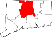
Wethersfield, Connecticut
Wethersfield, Connecticut | |
|---|---|
 Joseph Webb and Isaac Stevens houses | |
| Motto: Ye Most Auncient Towne in Connecticut[1] | |
| Coordinates: 41°42′51″N 72°39′09″W / 41.71417°N 72.65250°W | |
| Country | |
| U.S. state | |
| County | Hartford |
| Region | Capitol Region |
| Settled | October 1634 |
| Incorporated | February 21, 1637 |
| Named for | Wethersfield, Essex |
| Area | |
| • Total | 13.1 sq mi (34.0 km2) |
| • Land | 12.3 sq mi (31.9 km2) |
| • Water | 0.8 sq mi (2.1 km2) |
| Elevation | 43 ft (13 m) |
| Population (2020)[2] | |
| • Total | 27,298 |
| • Density | 2,100/sq mi (800/km2) |
| Time zone | UTC−5 (Eastern) |
| • Summer (DST) | UTC−4 (Eastern) |
| ZIP Code | 06109 |
| Area code(s) | 860/959 |
| FIPS code | 09-84900 |
| GNIS feature ID | 212042[3] |
| Interstates | |
| U.S. Highways | |
| State Routes | |
| Website | wethersfieldct |
Wethersfield is a town in Connecticut. It is in Hartford County. Many records from colonial times spell the name Weathersfield. However, Native Americans called it Pyquag. There were 27,298 people living in Wethersfield in 2020.[2]
References[change | change source]
Other websites[change | change source]
Wikimedia Commons has media related to Wethersfield, Connecticut.


