Windsor Locks, Connecticut
Windsor Locks, Connecticut | |
|---|---|
 The Windsor Locks Canal Company alongside the Enfield Falls Canal | |
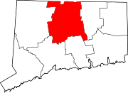
 Location within Hartford County, Connecticut | |
| Coordinates: 41°55′30″N 72°38′58″W / 41.92500°N 72.64944°W | |
| Country | |
| U.S. state | |
| County | Hartford |
| Settled | 1633 |
| Incorporated | 1854 |
| Area | |
| • Total | 9.4 sq mi (24.3 km2) |
| • Land | 9.0 sq mi (23.4 km2) |
| • Water | 0.3 sq mi (0.9 km2) |
| Elevation | 157 ft (48 m) |
| Population (2020)[1] | |
| • Total | 12,613 |
| • Density | 1,300/sq mi (520/km2) |
| Time zone | UTC-5 (Eastern) |
| • Summer (DST) | UTC-4 (Eastern) |
| ZIP Code | 06096 |
| Area code(s) | 860/959 |
| FIPS code | 09-87070 |
| GNIS feature ID | 0212355 |
| Major highways | |
| Website | www |
Windsor Locks is a town in Hartford County, Connecticut, United States. As of the 2020 census, there were 12,613 people living in the town.[1] It is served by Bradley International Airport. It is also the site of the New England Air Museum. It is beside the Connecticut River.
References[change | change source]
- ↑ 1.0 1.1 "Census - Geography Profile: Windsor Locks town, Hartford County, Connecticut". United States Census Bureau. Retrieved December 23, 2021.
Other websites[change | change source]


