Nara, Khyber Pakhtunkhwa
Nara | |
|---|---|
 Nara is in Abbottabad District | |
| Coordinates: 33°59′N 73°13′E / 33.983°N 73.217°E | |
| Country | |
| Province | Khyber Pakhtunkhwa |
| District | Abbottabad |
| Tehsil | Havelian |
| Government | |
| • Nazim | Sajjad[2] |
| • Naib Nazim | Saleem Akhtar |
| Population | |
| • Total | 15,690[1] |
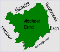
Nara is one of the 51 Union Councils of Abbottabad District in the Khyber Pakhtunkhwa province of Pakistan.[3] Nara is in the southern part of the district. The Union Council of Nara takes its name from the village of Nara. The main tribe of this Union Council are the Karlal.
Subdivisions[change | change source]
The Union Council of Nara is subdivided into the following areas: Changah, Dakhan, Gohra, Kanger Hoter, Kehan, Maira Ulla, Mari, Mohri-Badbhen, Nara and Satora.[2]
References[change | change source]
- ↑ "Census details of Unions Council in Abbottabad Tehsil". Archived from the original on 2007-06-27. Retrieved 2008-08-01.
- ↑ 2.0 2.1 Nara Union Council[permanent dead link]
- ↑ "Administrative Units of District Abbottabad". Archived from the original on 2007-04-03. Retrieved 2008-08-01.
