Die, Drôme
Die | |
|---|---|
Subprefecture and commune | |
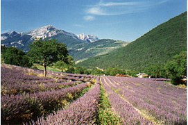
 A general view of Die | |
| Coordinates: 44°45′13″N 5°22′13″E / 44.7536°N 5.3703°E | |
| Country | France |
| Region | Auvergne-Rhône-Alpes |
| Department | Drôme |
| Arrondissement | Die |
| Canton | Le Diois |
| Intercommunality | Communauté de communes du Diois |
| Government | |
| • Mayor (2014-2020) | Gilbert Trémolet |
| Area 1 | 57.28 km2 (22.12 sq mi) |
| Population (2014) | 4,516 |
| • Density | 79/km2 (200/sq mi) |
| Time zone | UTC+01:00 (CET) |
| • Summer (DST) | UTC+02:00 (CEST) |
| INSEE/Postal code | 26113 /26150 |
| Elevation | 367–1,841 m (1,204–6,040 ft) (avg. 410 m or 1,350 ft) |
| 1 French Land Register data, which excludes lakes, ponds, glaciers > 1 km2 (0.386 sq mi or 247 acres) and river estuaries. | |
Die (Occitan: Diá) is a small city and commune in southeastern France in the Drôme department, of which it is a sub-prefecture. It is in the Auvergne-Rhône-Alpes region.
Geography
[change | change source]Die is in the eastern part of the Drôme department. The Drôme river, a tributary of the Rhône river, flows through the commune.
It has an area of 57.3 km2 (22.1 sq mi).[1] Its average altitude is 1,104 m (3,622 ft); at the city hall, the altitude is 402 m (1,319 ft).[2]
The distances from Die to other cities are:
- Paris, the national capital - 630 km (390 mi);
- Lyon, the regional capital - 170 km (110 mi);
- Marseille - 249 km (155 mi);
- Strasbourg - 660 km (410 mi);
- Reims - 654 km (406 mi);
- Bordeaux - 711 km (442 mi);
- Toulouse - 473 km (294 mi);
- Montpellier - 235 km (146 mi);
- Nice - 404 km (251 mi).

|
The commune of Die is surrounded by 8 communes: Chamaloc, Romeyer, Laval-d'Aix, Molières-Glandaz, Aix-en-Diois, Barsac, Ponet-et-Saint-Auban, Marignac-en-Diois.
Climate
[change | change source]The climate of Die, in the Köppen climate classification, is Cfb - Oceanic climate with template summers.
Population
[change | change source]The inhabitants of Die are known, in French, as Diois (women: Dioises).[3]
With a population of 4,516,[4] Die has a population density of 79 inhabitants/km2.
Evolution of the population in Die

Administration
[change | change source]Die is a sub-prefecture in the Drôme department since 1800. It is the capital of the Die arrondissement and is also the administrative centre (French: chef-lieu) of the canton of Le Diois formed by 63 communes, with 13,617 inhabitants (2014).[5]
Twin towns
[change | change source]Gallery
[change | change source]Related pages
[change | change source]References
[change | change source]- ↑ "Commune de Die (26113)". Comparateur de territoire (in French). Institut national de la statistique et des études économiques - INSEE. Retrieved 8 September 2017.
- ↑ "City of Die". Map-France.com. Retrieved 8 September 2017.
- ↑ "Drôme" (in French). habitants.fr. Retrieved 8 September 2017.
- ↑ "Régions, départements, arrondissements, cantons et communes" (PDF). Populations légales 2014 (in French). Institut national de la statistique et des études économiques - INSEE. Retrieved 8 September 2017.
- ↑ "Commune de Die (26113)". Géographie administrative et d’étude (in French). Institut national de la statistique et des études économiques - INSEE. Retrieved 8 September 2017.
- ↑ "Ville Jumelles" (in French). Mairie de Die. Archived from the original on 15 September 2017. Retrieved 8 September 2017.
Other websites
[change | change source]- Ville de Die - Official site (in French)
- Departamental Council website (in French)
- Prefecture website Archived 2011-09-29 at the Wayback Machine (in French)
- Drôme Tourisme (in French)
- Office de Tourisme du Pays Diois Archived 2015-12-22 at the Wayback Machine


