Freising (district)
Appearance
Freising | |
|---|---|
 | |
| Country | Germany |
| State | Bavaria |
| Adm. region | Upper Bavaria |
| Capital | Freising |
| Area | |
| • Total | 800 km2 (300 sq mi) |
| Population (31 December 2022)[1] | |
| • Total | 184,433 |
| • Density | 230/km2 (600/sq mi) |
| Time zone | UTC+01:00 (CET) |
| • Summer (DST) | UTC+02:00 (CEST) |
| Vehicle registration | FS |
| Website | lra-freising.bayern.de |


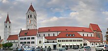
Freising is a rural district in Upper Bavaria in south Bavaria, Germany.
Towns and municipalities
[change | change source]
| Towns | Municipalities | |
|---|---|---|
References
[change | change source]- ↑ Genesis Online-Datenbank des Bayerischen Landesamtes für Statistik Tabelle 12411-003r Fortschreibung des Bevölkerungsstandes: Gemeinden, Stichtag (Einwohnerzahlen auf Grundlage des Zensus 2011) .
Other websites
[change | change source] Media related to Landkreis Freising at Wikimedia Commons
- Official website (German)
- Freising County Flag Archived 2021-07-17 at the Wayback Machine


