Hendry County, Florida
Hendry County | |
|---|---|
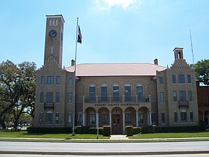
 The Hendry County Courthouse in LaBelle in 2010. | |
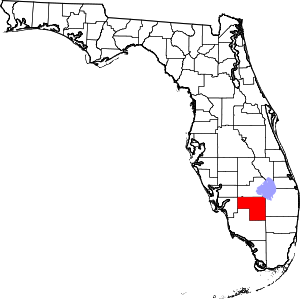
 Location within the U.S. state of Florida | |
 Florida's location within the U.S. | |
| Coordinates: 26°33′N 81°10′W / 26.55°N 81.17°W | |
| Country | |
| State | |
| Founded | May 11, 1923 |
| Named for | Francis A. Hendry |
| Seat | LaBelle |
| Largest city | Clewiston |
| Area | |
| • Total | 1,190 sq mi (3,100 km2) |
| • Land | 1,153 sq mi (2,990 km2) |
| • Water | 37 sq mi (100 km2) 3.1% |
| Population | |
| • Total | 39,619 |
| • Density | 33/sq mi (13/km2) |
| Time zone | UTC−5 (Eastern) |
| • Summer (DST) | UTC−4 (EDT) |
| Website | www |
Hendry County is a county in the U.S. state of Florida, and was formed on February 4, 1832. As of 2020, 39,619 people lived there.[1] Hendry County's seat is La Belle.
References[change | change source]
- ↑ 1.0 1.1 "QuickFacts: Hendry County, Florida". United States Census Bureau. Retrieved August 10, 2023.
Other websites[change | change source]

