Volusia County, Florida
Volusia County | |
|---|---|
 Volusia County courthouse in DeLand, built in 2001 | |
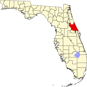
 Location within the U.S. state of Florida | |
 Florida's location within the U.S. | |
| Coordinates: 29°3′N 81°9′W / 29.050°N 81.150°W | |
| Country | |
| State | |
| Founded | December 29, 1854 |
| Named for | Community of Volusia |
| Seat | DeLand |
| Largest city | Deltona |
| Area | |
| • Total | 1,432 sq mi (3,710 km2) |
| • Land | 1,101 sq mi (2,850 km2) |
| • Water | 331 sq mi (860 km2) 23.14% |
| Population | |
| • Total | 553,543 |
| • Density | 503/sq mi (194/km2) |
| Time zone | UTC−5 (Eastern) |
| • Summer (DST) | UTC−4 (EDT) |
| Congressional district | 6th |
| Website | www |
Volusia County is a county in the east-central part of the U.S. state of Florida. It is bordered by St. Johns River to the west and the south, with the Atlantic Ocean to the east. The county was founded on December 29, 1854. At the 2020 census, 553,543 people lived there.[1] It is the sole county of the Deltona–Daytona Beach–Ormond Beach, FL Metropolitan Statistical Area. The county seat is DeLand, and the largest municipality is Deltona.
References[change | change source]
- ↑ 1.0 1.1 "QuickFacts: Volusia County, Florida". United States Census Bureau. Retrieved August 23, 2023.

