Kootenai, Idaho
Kootenai, Idaho | |
|---|---|
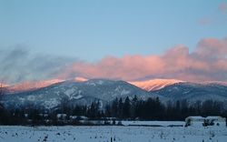
 Sunrise at Kootenai | |
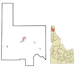
 Location in Bonner County and the state of Idaho | |
| Coordinates: 48°18′38″N 116°30′57″W / 48.31056°N 116.51583°W | |
| Country | United States |
| State | Idaho |
| County | Bonner |
| Area | |
| • Total | 0.55 sq mi (1.43 km2) |
| • Land | 0.55 sq mi (1.43 km2) |
| • Water | 0.00 sq mi (0.00 km2) |
| Elevation | 2,116 ft (645 m) |
| Population | |
| • Total | 941 |
| • Density | 1,700/sq mi (656/km2) |
| Time zone | UTC-8 (Pacific (PST)) |
| • Summer (DST) | UTC-7 (PDT) |
| ZIP code | 83840 |
| Area code | 208 |
| FIPS code | 16-44200 |
| GNIS feature ID | 0397837 |
Kootenai is a city in Idaho in the United States. It is in Bonner County.
References[change | change source]
- ↑ "2020 U.S. Gazetteer Files". United States Census Bureau. Retrieved September 19, 2023.
- ↑ "Kootenai city, Idaho". United States Census Bureau. Retrieved September 19, 2023.

