Idaho Falls
Appearance
(Redirected from Idaho Falls, Idaho)
Idaho Falls, Idaho | |
|---|---|
 Downtown Idaho Falls | |
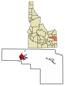
 Location within Bonneville County | |
| Coordinates: 43°30′N 112°2′W / 43.500°N 112.033°W | |
| Country | United States |
| State | Idaho |
| County | Bonneville |
| Founded | 1864 |
| Incorporated | 1891 |
| Area | |
| • Total | 24.55 sq mi (63.59 km2) |
| • Land | 24.00 sq mi (62.16 km2) |
| • Water | 0.56 sq mi (1.44 km2) |
| Elevation | 4,705 ft (1,434 m) |
| Population | |
| • Total | 64,818 |
| • Density | 2,700.5/sq mi (1,042.7/km2) |
| • CSA | 243,805 (US: 124th) |
| Time zone | UTC−7 (Mountain) |
| • Summer (DST) | UTC−6 (Mountain) |
| ZIP Code | 83401-83406, 83415 |
| Area code(s) | 208, 986 |
| FIPS code | 16-39700 |
| GNIS feature ID | 396684[3] |
| Interstate | |
| U.S. Highway(s) | |
| State Highway | |
| Website | Official website |
Idaho Falls is the biggest city of Bonneville County in the state of Idaho, United States. It is the county seat of Bonneville County. It is one of the largest cities in Idaho. Many Mormons live there. The fourth Mormon temple outside of Utah was built there.
References
[change | change source]- ↑ "2020 U.S. Gazetteer Files". United States Census Bureau. Retrieved September 19, 2023.
- ↑ "QuickFacts: Idaho Falls city, Idaho". United States Census Bureau. Retrieved September 19, 2023.
- ↑ "Idaho Falls". Geographic Names Information System. United States Geological Survey.
Wikimedia Commons has media related to Idaho Falls.


