
Lot (river)
| Lot | |
|---|---|
 | |
.png) | |
| Location | |
| Country | France |
| Physical characteristics | |
| Source | |
| - location | Cévennes |
| - coordinates | 44°30′54″N 3°47′05″E / 44.51493°N 3.78462°E |
| - elevation | 1,499 m (4,918 ft) |
| Mouth | |
| - location | Garonne |
| - coordinates | 44°19′0″N 0°20′6″E / 44.31667°N 0.33500°E |
| Length | 485 km (301 mi) |
| Basin size | 11,254 km2 (4,345 sq mi) |
| Discharge | |
| - average | 155 m3/s (5,500 cu ft/s) |
| Basin features | |
| Progression | Garonne→ Atlantic Ocean |
The Lot (Occitan: Olt) is a river in southern France, tributary of the Garonne river. The Lot department is named after this river.
Geography[change | change source]
The Lot river has a length of 290.7 kilometres (180.6 miles) and a drainage basin with an area of 11,400 square kilometres (4,402 square miles).[1]
Its average yearly discharge is 155 cubic metres per second (5,500 cubic feet per second) at Villeneuve-sur-Lot.[2]
Course[change | change source]
The source of the Lot is on the Mont Lozère, in the Cévennes, southeastern Massif Central, in the commune of Le Bleymard, in the Lozère department, at an altitude of about 1,272 metres (4,173 feet).[3]
The Lot flows, with many meanders, to the west, in general, and passes through the following regions, departments and communes:
- Occitanie region
- Auvergne-Rhône-Alpes region
- Cantal: Vieillevie, Saint-Projet-de-Salers, the river is the border between Aveyron and Cantal for several kilometres to the north of Conques
- Occitanie region
- Nouvelle-Aquitaine region
The Lot river flows through 131 communes.[1]
Finally, it flows, as a right tributary into the Garonne near Aiguillon, in the Lot-et-Garonne department, at 23 metres (75 feet) of altitude.[4]
Main tributaries[change | change source]

- Left tributaries
- Right tributaries
- Colagne - 58.4 kilometres (36.3 miles)[10]
- Boralde de Saint-Chély-d'Aubrac - 25.1 kilometres (15.6 miles)[11]
- Boralde Flaujaguèse - 29.3 kilometres (18.2 miles)[12]
- Truyère - 167.2 kilometres (103.9 miles)[13]
- Célé - 104.4 kilometres (64.9 miles)[14]
- Thèze - 26.6 kilometres (16.5 miles)[15]
- Lémance - 34.5 kilometres (21.4 miles)[16]
- Lède - 54.1 kilometres (33.6 miles)[17]
Gallery[change | change source]
-
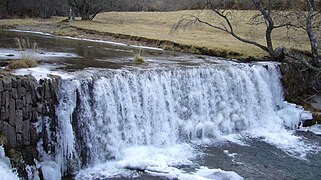 The Lot at Tournel, Lozère
 -
 The Lot at Luzech
 -
 The Lot at Cahors
 -
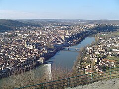
 The Lot at Villeneuve-sur-Lot


Related pages[change | change source]
References[change | change source]
- ↑ 1.0 1.1 "Le Lot (O---0150)" (in French). SANDRE - Portail national d'accès aux référentiels sur l'eau. Archived from the original on 3 March 2016. Retrieved 22 May 2014.
- ↑ "Le Lot à Villeneuve-sur-Lot" (in French). Banque Hydro. Archived from the original on 14 December 2017. Retrieved 22 May 2014.
- ↑ "Source du Lot" (in French). Géoportail. Retrieved 22 May 2014.
- ↑ "Confluence du Lot" (in French). Géoportail. Retrieved 22 May 2014.
- ↑ "Le Bramont (O7030500)" (in French). SANDRE - Portail national d'accès aux référentiels sur l'eau. Archived from the original on 3 March 2016. Retrieved 22 May 2014.
- ↑ "e Dourdou de Conques (O80-0400)" (in French). SANDRE - Portail national d'accès aux référentiels sur l'eau. Archived from the original on 3 March 2016. Retrieved 22 May 2014.
- ↑ "Riou Mort (O81-0400)" (in French). SANDRE - Portail national d'accès aux référentiels sur l'eau. Archived from the original on 11 December 2015. Retrieved 22 May 2014.
- ↑ "La Diège (O8160500)" (in French). SANDRE - Portail national d'accès aux référentiels sur l'eau. Archived from the original on 3 March 2016. Retrieved 22 May 2014.
- ↑ "Le Boudouyssou (O86-0400)" (in French). SANDRE - Portail national d'accès aux référentiels sur l'eau. Archived from the original on 2 January 2016. Retrieved 22 May 2014.
- ↑ "La Colagne (O71-0400)" (in French). SANDRE - Portail national d'accès aux référentiels sur l'eau. Archived from the original on 21 December 2015. Retrieved 22 May 2014.
- ↑ "Boralde de Saint-Chély d'Aubrac (O7240520)" (in French). SANDRE - Portail national d'accès aux référentiels sur l'eau. Archived from the original on 3 March 2016. Retrieved 22 May 2014.
- ↑ "Boralde Flaujaguèse (O7250500)" (in French). SANDRE - Portail national d'accès aux référentiels sur l'eau. Archived from the original on 3 March 2016. Retrieved 22 May 2014.
- ↑ "La Truyère (O7--0250)" (in French). SANDRE - Portail national d'accès aux référentiels sur l'eau. Archived from the original on 3 March 2016. Retrieved 22 May 2014.
- ↑ "Le Célé (O8--0250)" (in French). SANDRE - Portail national d'accès aux référentiels sur l'eau. Archived from the original on 3 March 2016. Retrieved 22 May 2014.
- ↑ "La Thèze (O85-0400)" (in French). SANDRE - Portail national d'accès aux référentiels sur l'eau. Archived from the original on 4 March 2016. Retrieved 22 May 2014.
- ↑ "La Lémance (O85-0430)" (in French). SANDRE - Portail national d'accès aux référentiels sur l'eau. Archived from the original on 3 March 2016. Retrieved 22 May 2014.
- ↑ "La Lède (O87-0400)" (in French). SANDRE - Portail national d'accès aux référentiels sur l'eau. Archived from the original on 2 June 2012. Retrieved 22 May 2014.
Other websites[change | change source]
- Banque Hydro - Station O8481520 - Le Lot à Villeneuve-sur-Lot Archived 2015-02-19 at the Wayback Machine (in French)