
Laramie County, Wyoming
Laramie County | |
|---|---|
 City/County Building at Cheyenne in 1981 | |
 Flag | |
 Location within the U.S. state of Wyoming | |
 Wyoming's location within the U.S. | |
| Coordinates: 41°19′N 104°41′W / 41.32°N 104.69°W | |
| Country | |
| State | |
| Founded | January 9, 1867 |
| Named for | Jacques La Ramee |
| Seat | Cheyenne |
| Largest city | Cheyenne |
| Area | |
| • Total | 2,688 sq mi (6,960 km2) |
| • Land | 2,686 sq mi (6,960 km2) |
| • Water | 1.6 sq mi (4 km2) 0.06% |
| Population (2020) | |
| • Total | 100,512 |
| • Density | 37.39/sq mi (14.44/km2) |
| Time zone | UTC−7 (Mountain) |
| • Summer (DST) | UTC−6 (MDT) |
| Congressional district | At-large |
| Website | laramiecounty |
Laramie County is a county in the U.S. state of Wyoming. As of the 2020 United States Census, 100,512 people lived there.[1] The county seat is Cheyenne, the state capital.[2] The county lies west of the Nebraska state line and north of the Colorado state line.
The city of Laramie, Wyoming, is in neighboring Albany County.
History[change | change source]
Laramie County was created on January 9, 1867.[3]
Geography[change | change source]
According to the US Census Bureau, the county has a total area of 2,688 square miles (6,960 km2), of which 2,686 square miles (6,960 km2) is land and 1.6 square miles (4.1 km2) (0.06%) is water.[4]
Bordering counties[change | change source]
- Goshen County – north
- Banner County, Nebraska – northeast
- Kimball County, Nebraska – east
- Weld County, Colorado – south
- Larimer County, Colorado – southwest
- Albany County – west
- Platte County – northwest
Communities[change | change source]
City[change | change source]
- Cheyenne (county seat)
Towns[change | change source]
Census-designated places[change | change source]
Unincorporated communities[change | change source]
- Altvan
- Egbert
- Granite
- Horse Creek
- Meriden
References[change | change source]
- ↑ "QuickFacts: Laramie County, Wyoming". United States Census Bureau. Retrieved January 21, 2024.
- ↑ "Find a County". National Association of Counties. Retrieved June 7, 2011.
- ↑ Long, John H. (2006). "Wyoming: Individual County Chronologies". Wyoming Atlas of Historical County Boundaries. The Newberry Library. Archived from the original on July 18, 2011. Retrieved September 1, 2011.
- ↑ "2010 Census Gazetteer Files". US Census Bureau. August 22, 2012. Retrieved August 18, 2015.
Other websites[change | change source]
Wikimedia Commons has media related to Laramie County, Wyoming.
- Laramie County official website Archived 2010-03-25 at the Wayback Machine
Places next to Laramie County, Wyoming | |
|---|---|
Municipalities and communities of Laramie County, Wyoming, United States | ||
|---|---|---|
| City | 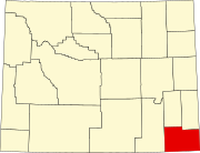 | |
| Towns | ||
| CDPs | ||
| Unincorporated communities | ||