Washakie County, Wyoming
Appearance
Washakie County | |
|---|---|
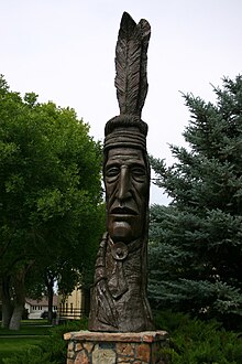
 Indian Totem in Worland | |
 Location within the U.S. state of Wyoming | |
 Wyoming's location within the U.S. | |
| Coordinates: 43°55′N 107°41′W / 43.91°N 107.68°W | |
| Country | |
| State | |
| Founded | February 21, 1911 (authorized) 1913 (organized) |
| Named for | Chief Washakie |
| Seat | Worland |
| Largest city | Worland |
| Area | |
| • Total | 2,243 sq mi (5,810 km2) |
| • Land | 2,239 sq mi (5,800 km2) |
| • Water | 4.2 sq mi (11 km2) 0.2% |
| Population (2020) | |
| • Total | 7,685 |
| • Density | 3.4/sq mi (1.3/km2) |
| Time zone | UTC−7 (Mountain) |
| • Summer (DST) | UTC−6 (MDT) |
| Congressional district | At-large |
| Website | www |
Washakie County is a county in the U.S. state of Wyoming. As of the 2020 census, 7,685 people lived there.[1] Its county seat is Worland.[2] The county was created on February 21, 1911.[3]
Communities
[change | change source]City
[change | change source]- Worland (county seat)
Town
[change | change source]Census-designated places
[change | change source]Unincorporated community
[change | change source]- Big Trails
References
[change | change source]- ↑ "QuickFacts: Washakie County, Wyoming". United States Census Bureau. Retrieved January 21, 2024.
- ↑ "Find a County". National Association of Counties. Retrieved June 7, 2011.
- ↑ Long, John H., ed. (2004). "Wyoming: Individual County Chronologies". Wyoming Atlas of Historical County Boundaries. The Newberry Library. Archived from the original on August 3, 2015. Retrieved August 19, 2015.
Other websites
[change | change source]Wikimedia Commons has media related to Washakie County, Wyoming.
