Ploiești
Appearance
Ploieşti | |
|---|---|
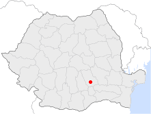
 Location of Ploieşti | |
| Coordinates: 44°56′24″N 26°1′48″E / 44.94000°N 26.03000°E | |
| Country | |
| County | Prahova County |
| Status | County seat |
| Government | |
| • Mayor | Andrei Volosevici (Democratic Liberal Party) |
| Area | |
| • City | 58.2 km2 (22.5 sq mi) |
| Population (2002) | |
| • City | 232,527 |
| • Density | 3,990/km2 (10,300/sq mi) |
| • Metro | 327,923 |
| • Jan. 1, 2006 | 250,541 |
| Time zone | UTC+2 (EET) |
| • Summer (DST) | UTC+3 (EEST) |
| Website | http://www.ploiesti.ro/ |
Ploieşti is the county seat. of Prahova County. It can be found in the historical region of Wallachia in Romania. About 232,500 people were living in Ploieşti as of the year 2002.
Sister cities
[change | change source]These are the sister cities of Ploieşti:
|
References
[change | change source]- ↑ "Radom - Miasta partnerskie" [Radom - Partnership cities]. Miasto Radom [City of Radom] (in Polish). Archived from the original on 2013-04-03. Retrieved 2013-08-07.
- ↑ "Radom - miasta partnerskie" (in Polish). radom.naszestrony.pl. Archived from the original on 2007-07-26. Retrieved 2013-08-07.
Other websites
[change | change source]Wikimedia Commons has media related to Ploiești.


