
Guntersville, Alabama
Guntersville, Alabama | |
|---|---|
 Location in Marshall County, Alabama | |
| Coordinates: 34°20′53″N 86°17′40″W / 34.34806°N 86.29444°W | |
| Country | United States |
| State | Alabama |
| County | Marshall |
| Area | |
| • Total | 42.70 sq mi (110.59 km2) |
| • Land | 25.64 sq mi (66.39 km2) |
| • Water | 17.06 sq mi (44.19 km2) |
| Elevation | 607 ft (185 m) |
| Population | |
| • Total | 8,553 |
| • Density | 333.65/sq mi (128.82/km2) |
| Time zone | UTC−6 (Central (CST)) |
| • Summer (DST) | UTC−5 (CDT) |
| ZIP Code | 35976 |
| Area code | 256 |
| FIPS code | 01-32416 |
| GNIS feature ID | 2403774[2] |
| Website | guntersvilleal |
Guntersville is a city in Marshall County, Alabama, United States and is included in the Huntsville-Decatur Combined Statistical Area. At the 2020 census, the population of the city was 8,553.[3] The city is the county seat of Marshall County.
References[change | change source]
- ↑ "2021 U.S. Gazetteer Files". United States Census Bureau. Retrieved April 15, 2022.
- ↑ 2.0 2.1 U.S. Geological Survey Geographic Names Information System: Guntersville, Alabama
- ↑ 3.0 3.1 "Guntersville city, Alabama: 2020 DEC Redistricting Data (PL 94-171)". U.S. Census Bureau. Retrieved April 15, 2022.
Municipalities and communities of Marshall County, Alabama, United States | ||
|---|---|---|
| Cities | 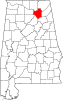 | |
| Towns | ||
| CDPs | ||
| Unincorporated communities | ||
| Ghost town | ||
| Footnotes | ‡This populated place also has portions in an adjacent county or counties | |

| International | |
|---|---|
| National | |
| Geographic | |