
Electoral district of Burnett
| Burnett Queensland—Legislative Assembly | |||||||||||||||
|---|---|---|---|---|---|---|---|---|---|---|---|---|---|---|---|
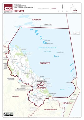 Map of the electoral district of Burnett, 2017 | |||||||||||||||
| State | Queensland | ||||||||||||||
| Dates current | 1860–1932 1960–present | ||||||||||||||
| MP | Stephen Bennett | ||||||||||||||
| Party | Liberal National | ||||||||||||||
| Namesake | Burnett River | ||||||||||||||
| Electors | 35,928 (2020) | ||||||||||||||
| Area | 7,687 km2 (2,968.0 sq mi) | ||||||||||||||
| Demographic | Rural | ||||||||||||||
| Coordinates | 24°37′S 152°2′E / 24.617°S 152.033°E | ||||||||||||||
| |||||||||||||||
Burnett is an electoral district of Queensland. It was created in 1860, abolished in 1932 and recreated in 1960.
Election results[change | change source]
| 2020 Queensland state election: Burnett[1] | |||||
|---|---|---|---|---|---|
| Party | Candidate | Votes | % | ±% | |
| Liberal National | Stephen Bennett | 15,330 | 48.61 | +6.16 | |
| Labor | Kerri Morgan | 9,686 | 30.71 | +5.42 | |
| One Nation | Geoffrey Mansell | 2,832 | 8.98 | −17.72 | |
| Greens | Liam Johns | 1,436 | 4.55 | −1.00 | |
| Katter's Australian | Paul Hudson | 1,336 | 4.24 | +4.24 | |
| Informed Medical Options | Elizabeth Case | 682 | 2.16 | +2.16 | |
| Independent | Ric Glass | 235 | 0.75 | +0.75 | |
| Total formal votes | 31,537 | 96.01 | −0.08 | ||
| Informal votes | 1,311 | 3.99 | +0.08 | ||
| Turnout | 32,848 | 91.43 | +0.82 | ||
| Two-party-preferred result | |||||
| Liberal National | Stephen Bennett | 19,172 | 60.79 | +0.14 | |
| Labor | Kerri Morgan | 12,365 | 39.21 | −0.14 | |
| Liberal National hold | Swing | +0.14 | |||