
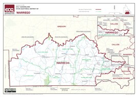
Electoral district of Warrego
| Warrego Queensland—Legislative Assembly | |||||||||||||||
|---|---|---|---|---|---|---|---|---|---|---|---|---|---|---|---|
 Electoral map of Warrego 2017 | |||||||||||||||
| State | Queensland | ||||||||||||||
| Created | 1865 | ||||||||||||||
| MP | Ann Leahy | ||||||||||||||
| Party | Liberal National | ||||||||||||||
| Namesake | Warrego River | ||||||||||||||
| Electors | 29,307 (2020) | ||||||||||||||
| Area | 337,812 km2 (130,429.9 sq mi) | ||||||||||||||
| Demographic | Rural | ||||||||||||||
| Coordinates | 26°52′S 146°9′E / 26.867°S 146.150°E | ||||||||||||||
| |||||||||||||||
Warrego is an electoral district of Queensland. It was created in 1865.
Election results[change | change source]
| 2020 Queensland state election: Warrego[1] | |||||
|---|---|---|---|---|---|
| Party | Candidate | Votes | % | ±% | |
| Liberal National | Ann Leahy | 14,100 | 55.98 | +8.35 | |
| Labor | Mark O'Brien | 4,966 | 19.72 | −1.97 | |
| Katter's Australian | Rick Gurnett | 2,842 | 11.28 | −9.96 | |
| One Nation | Joshua Coyne | 2,224 | 8.83 | +8.83 | |
| Greens | Joshua Sanderson | 569 | 2.26 | −0.83 | |
| Independent | Mark Stone | 487 | 1.93 | −1.51 | |
| Total formal votes | 25,188 | 97.97 | +2.17 | ||
| Informal votes | 521 | 2.03 | −2.17 | ||
| Turnout | 25,709 | 87.72 | −0.71 | ||
| Two-party-preferred result | |||||
| Liberal National | Ann Leahy | 18,424 | 73.15 | +13.69 | |
| Labor | Mark O'Brien | 6,764 | 26.85 | +26.85 | |
| Liberal National hold | Swing | +13.69 | |||